
resources
Explore Florida Maps by Cities: Interactive Tools and Detailed Guides
17 Nov 2025

Considering a journey to Florida? While its renowned theme parks and pristine beaches often capture the spotlight, this diverse state offers so much more. In fact, Florida is home to a myriad of cities, each boasting its own unique character and appeal. Whether your interests lie in a vibrant, bustling urban core or a tranquil waterfront retreat, you're sure to find a destination that resonates. Leveraging detailed maps—particularly those allowing for granular city-specific views—can be immensely beneficial in pinpointing ideal locations and must-see attractions. This approach significantly streamlines your travel preparations, ensuring you discover all the captivating experiences the Sunshine State has to offer.
Key Takeaways
- Grasping the intricacies of map legends and scales is paramount for effective trip planning within Florida's urban landscape.
- Major Florida cities such as Miami, Orlando, and Tampa present distinct offerings, ranging from rich cultural scenes and world-class theme parks to compelling historical narratives and vibrant artistic communities.
- Delightful smaller cities—including St. Petersburg, Fort Lauderdale, and Sarasota—charm visitors with their picturesque waterfronts, burgeoning arts scenes, and stunning beaches.
- Navigating Florida's cities is highly adaptable, offering various modes of transport such as personal vehicles, public transit, walking, or convenient ride-sharing services.
- For in-depth planning, interactive digital maps and Geographic Information Systems (GIS) data provide invaluable, detailed insights into Florida's diverse urban environments.
Understanding Florida Maps By Cities
Interpreting Map Legends and Symbols
When you first encounter a comprehensive map of Florida's cities, the sheer volume of destinations might appear somewhat daunting, wouldn't you agree? Yet, with a little practice, this seemingly complex diagram transforms into an indispensable planning tool. Consider it your authoritative guide to all of Florida's captivating locations, from sprawling metropolitan areas to quaint, lesser-known towns.
To truly begin your cartographic journey, your initial step should be to consult the map's legend. Typically situated in a corner or along the periphery, this crucial key deciphers the myriad of symbols, icons, and color codings employed. For instance, a robust blue line could signify a major highway, while a more delicate dotted line might represent a secondary road. Grasping these conventions is fundamental to accurately charting your course and determining optimal travel paths between points of interest.
Here’s a quick look at what some common symbols might mean:
- Cities/Towns: Often shown as dots. Bigger cities might have a star or a larger circle.
- Major Highways: Usually thick lines, often colored (like blue for Interstates).
- State/County Roads: Thinner lines, showing connections between smaller places.
- Parks/Recreation Areas: Might be shown as green shaded areas or specific icons.
Gauging Distances with Map Scales
Beyond mere symbols, maps also feature a scale—a critically important element for accurately assessing real-world distances. You'll generally find it presented as a graphic bar scale, indicating how many miles or kilometers a specific linear measurement on the map corresponds to. For example, if the scale dictates that one inch represents ten miles, and two cities appear three inches apart on the map, their actual separation in reality is approximately thirty miles. This vital insight empowers more precise trip planning, preventing unexpected lengthy journeys.
| Map Distance | Real-World Distance |
|---|---|
| 1 inch | 10 miles |
| 2 inches | 20 miles |
| 3 inches | 30 miles |
Identifying Key Geographic Features
Maps are also instrumental in highlighting significant natural and anthropogenic features. You'll typically observe distinct symbols denoting elements such as:
- Water Bodies: Lakes, rivers, and the ocean are usually shown in blue.
- Airports: Often marked with a little airplane symbol.
- Points of Interest: Sometimes special icons are used for landmarks or attractions.
Grasping these fundamental map elements—the legend, the scale, and the various feature symbols—serves as the foundational step toward a comprehensive exploration of Florida. This knowledge transforms a seemingly two-dimensional representation into an invaluable strategic asset for orchestrating your adventures, whether your destination is a bustling metropolis or a serene coastal community.
Indeed, by dedicating a few moments to familiarize yourself with these essential map components, you'll find yourself considerably better equipped to select optimal routes, accurately estimate travel durations, and uncover the myriad unique destinations Florida so generously provides.
Exploring Florida's Major Urban Centers
Florida, as we know, offers far more than its celebrated beaches and world-class theme parks, though it certainly possesses these in abundance. The state’s cities, for instance, stand as vibrant epicenters, each imbued with its own distinct personality and an impressive array of experiences awaiting discovery. Let's delve deeper into some of the primary urban centers that truly shape Florida's diverse landscape.
Miami: A Vibrant Cultural Hub
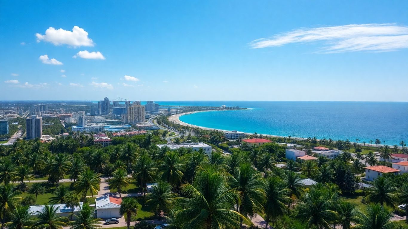
Miami truly pulses with an undeniable energy—it's a city whose vibrancy is simply captivating. World-renowned for its stunning Art Deco architecture, particularly evident in locales like South Beach, its pristine beaches are likewise celebrated globally. Yet, Miami is equally distinguished as a genuine cultural melting pot, where profound Latin American influences permeate its culinary traditions, musical landscape, and overarching atmosphere. This rich amalgamation creates an exceptionally compelling destination, providing a mosaic of distinct cultures within one dynamic urban setting.
Orlando: The Theme Park Capital
Indeed, when the name Orlando is uttered, theme parks often spring to mind almost instinctively, and for very valid reasons. As a global magnet for sprawling entertainment complexes, it annually attracts millions of eager visitors. However, Orlando has evolved considerably beyond mere rides and spectacles. It now proudly cultivates a burgeoning culinary scene and offers convenient access to Florida's inherent natural splendor, including nearby crystal-clear springs and verdant parks. Truly, it's a destination where the enchantment gracefully extends well beyond the iconic park gates.
Tampa: A Metropolis of History and Arts
Nestled along Florida's captivating west coast, Tampa masterfully intertwines contemporary allure with a profound historical legacy. Its picturesque waterfront remains a highly favored destination, while the city ardently champions a vibrant and active arts community. Tampa likewise preserves its rich Cuban heritage, particularly within the storied Ybor City neighborhood—an excellent locale, incidentally, for truly appreciating the area's multifaceted past.
Embarking on an exploration of these prominent cities provides an exceptional entry point for comprehending Florida's rich tapestry of urban environments. Each possesses a singular narrative and a distinctive character, collectively enhancing the state's broad appeal.
Discovering Unique City Charms Across Florida

Florida's cities, it must be said, are far more than mere geographic coordinates on a map; each possesses a distinct personality and an array of compelling attributes that render it unique. Beyond the widely celebrated attractions, it is often the more subtle, idiosyncratic elements that truly imbue a locale with its singular character. Let's examine a few illustrative examples that wonderfully showcase this inherent diversity.
St. Petersburg's Artistic Waterfront
St. Petersburg—affectionately known as "St. Pete" among its residents—is gracefully situated on the Pinellas Peninsula, commanding a prime position on Tampa Bay. It enjoys renown for its breathtaking waterfront parks and, perhaps surprisingly, a remarkably robust arts scene. The city has conscientiously cultivated its reputation as a premier destination for art enthusiasts, exemplified by institutions like the world-class Dalí Museum, which proudly safeguards an unparalleled collection of Salvador Dalí's masterworks. Visitors can readily immerse themselves in a day of gallery hopping, savoring the radiant sunshine along the bay, or even catching an impromptu live musical performance. The waterfront itself is a significant attraction, replete with inviting walking paths, scenic piers, and numerous tranquil spots perfect for observing the maritime activity. Indeed, it exudes a palpably more relaxed ambiance than some of Florida's larger cities, presenting a delightful synthesis of cultural enrichment and coastal serenity.
Fort Lauderdale's Scenic Canals and Beaches
Situated just north of bustling Miami, Fort Lauderdale is celebrated for its glorious beaches and, perhaps to a lesser extent, its intricate and extensive network of canals. Affectionately dubbed the "Venice of America," this city proudly boasts over 300 miles of navigable waterways. Consequently, it stands as an exceptional destination for indulging in leisurely boat tours, utilizing convenient water taxis, or simply relishing the panoramic views from exquisite waterfront dining establishments. While its sun-drenched beaches undeniably serve as a principal magnet for coastal enthusiasts, the canals introduce a distinctly unique dimension, providing an alternative perspective on the city and its magnificent residences. It is, quite literally, a place where one can effortlessly transition from tranquil relaxation on the sandy shores to an engaging exploration by boat.
Sarasota's Cultural Scene and Coastal Proximity
On Florida's enchanting Gulf Coast lies Sarasota, a city that truly excels in blending a rich arts and cultural milieu with its stunning natural environment. It proudly hosts the esteemed Ringling Museum of Art, which, notably, encompasses a dedicated circus museum, and fosters a dynamic performing arts community with numerous theaters and music venues. Yet, Sarasota’s appeal transcends culture alone; it is equally renowned for its spectacular beaches, such as the globally recognized Siesta Key, celebrated for its uniquely powdery white sand. The city emanates a distinctly sophisticated aura, drawing those who appreciate exquisite dining, discerning boutique shopping, and an overall ambiance that is both refined and comfortably relaxed. Its favorable coastal proximity ensures that invigorating outdoor pursuits are perpetually within easy reach, seamlessly merging sophisticated urban amenities with breathtaking natural beauty.
Indeed, delving into these diverse cities unequivocally demonstrates that Florida extends a broad spectrum of experiences. From St. Petersburg's vibrant artistic flair to Fort Lauderdale's captivating watery allure and Sarasota's profound cultural richness, each location contributes a distinctive essence to the Sunshine State. It is precisely these individual characteristics, wouldn't you agree, that render the meticulous planning of your travels so profoundly gratifying?
Here's a quick look at what sets these cities apart:
- St. Petersburg: Known for its vibrant arts scene, particularly the Dalí Museum, and its scenic waterfront parks along Tampa Bay.
- Fort Lauderdale: Famous for its beautiful beaches and extensive canal system, earning it the nickname "Venice of America."
- Sarasota: Offers a sophisticated blend of cultural attractions, including the Ringling Museum, and proximity to world-renowned beaches like Siesta Key.
Navigating Your Florida City Adventures
Navigating Florida's cities typically presents little difficulty, offering a variety of transportation methods to suit individual preferences and itineraries. Ultimately, selecting the most appropriate mode of travel can significantly enhance the fluidity of your journey.
Choosing the Right Transportation Methods
- Driving (Rental Car): This option affords unparalleled autonomy, allowing you to traverse destinations at your leisure. It proves especially advantageous for venturing beyond central urban zones or efficiently visiting multiple attractions within a single day. Do bear in mind, however, that securing parking in bustling downtown districts can occasionally be challenging and may incur additional charges.
- Public Transit: Often representing the most economical choice, public transit systems typically service major tourist attractions and key city areas. Service frequency, naturally, can vary considerably based on the specific city and time of day; therefore, it is always prudent to consult schedules in advance.
- Walking and Biking: These modes are ideal for intimately exploring distinct neighborhoods or traversing shorter distances. Indeed, they offer the most immersive means to absorb the local ambiance, serendipitously discover charming, out-of-the-way cafes, and simply savor the urban environment at a deliberate pace.
- Taxis and Ride-Sharing: For direct point-to-point journeys, particularly during evening hours or when managing luggage, taxis and ride-sharing services offer considerable convenience. It is worth noting, however, that frequent reliance on these options can certainly accumulate costs.
Understanding Road Classifications for Travel
A clear understanding of road classifications can significantly aid in optimizing your route planning. Broadly speaking, you will encounter the following categories:
- Interstates/Highways: These are the major, high-speed routes connecting cities and regions. They're designed for long-distance travel and usually have limited access points.
- US Highways/State Roads: These are major arteries within and between cities, often with more exits and services than interstates. They can be a good balance between speed and accessibility.
- Local Roads/Arterials: These are the streets within cities and towns. They range from main thoroughfares that carry a lot of traffic to smaller streets in residential areas.
Strategically planning your route with a map—be it digital or traditional—and appreciating these distinct road classifications will undoubtedly help you circumvent delays on slower local roads when your itinerary necessitates expeditious travel.
Leveraging Public Transit Systems Effectively
To maximize your experience with Florida's public transportation infrastructure, consider these proactive measures:
- Research Before You Go: Visit the website of the local transit authority for the city you're visiting. Look for route maps, schedules, and fare information.
- Consider Day or Week Passes: If you plan on using public transit frequently, these passes often offer significant savings compared to paying for individual rides.
- Use Transit Apps: Many cities have apps that provide real-time bus tracking, trip planning, and mobile ticketing options, making the experience much easier.
- Be Aware of Peak Hours: Buses and trains can get crowded during morning and evening commutes. Factor this into your travel time if you're on a tight schedule.
Interactive Tools for Florida City Exploration
Utilizing GIS Data for Urban Planning
Geographic Information Systems (GIS) data represents an exceptionally potent resource for comprehending the intricate spatial organization and operational dynamics of Florida's cities. One might best conceptualize it as a sophisticated digital blueprint, meticulously layering various types of information. Urban planners, for instance, routinely leverage this data to ascertain optimal locations for new infrastructural developments such as roads, parks, or residential projects. By analyzing, say, population density maps in conjunction with existing transportation arteries, they can strategically determine the most suitable placement for a new bus route. This calibre of data is indispensable for fostering informed decision-making regarding urban growth and infrastructure enhancements.
Customizing and Analyzing Digital Maps
Whether you're meticulously planning an upcoming journey or simply indulging a curiosity about a particular locale, digital maps provide an extensive degree of flexibility. They frequently allow for precise customization of displayed information—for example, toggling layers for points of interest, real-time traffic conditions, or even historical markers. The analytical capabilities of these maps can extend to examining travel durations between distinct urban sectors or pinpointing neighborhoods replete with specific amenities. The ability to tailor a map precisely to your requirements dramatically enhances the efficiency of your exploration.
Here are a few ways you can customize digital maps:
- Add or remove layers: Show or hide things like parks, schools, or specific types of businesses.
- Measure distances and areas: Calculate how far it is between two points or the size of a particular zone.
- Create routes: Plan your journey, whether by car, public transport, or even walking.
Accessing Pre-Assembled Geographic Datasets
In addition to dynamic, interactive map tools, a wealth of pre-assembled geographic datasets are readily accessible. These comprehensive collections can encompass an extensive array of subjects, spanning from detailed census information and prevailing land-use patterns to critical environmental data and historical demarcation lines. Researchers, students, and dedicated enthusiasts alike can procure these datasets to conduct their own nuanced analyses or to construct bespoke maps for specialized projects. One might aptly describe it as having a vast library of geographic intelligence quite literally at one's fingertips, poised for intricate exploration and insightful interpretation.
Typically, these robust datasets are meticulously compiled by authoritative government agencies or esteemed research institutions. They offer a highly structured pathway to access granular information concerning specific geographic regions, thereby facilitating a depth of study often unattainable through conventional online map services.
Beyond the Metropolis: Florida's Diverse Locales
Florida is unequivocally a state that presents a vast spectrum of experiences, reaching far beyond its globally recognized major cities and iconic theme parks. While dynamic urban centers like Miami and Orlando frequently command attention, the Sunshine State is also gracefully punctuated by charming smaller towns and unparalleled natural areas, each imbued with its own singular allure and storied past. Consequently, appreciating these diverse locales can truly furnish a far richer, more nuanced understanding of Florida's intrinsic character.
Tallahassee: The State Capital's Historical Significance
As the seat of Florida's government, Tallahassee occupies a uniquely significant position within the state's historical and political narrative. This city distinctly contrasts with the effervescent southern hubs, instead presenting a more tranquil—and profoundly historically rich—ambiance. Visitors will discover exquisite antebellum architecture, a plethora of museums meticulously detailing Florida's past, and a palpable connection to its pivotal role as the nucleus of state administration. It is, in essence, a destination where one can genuinely grasp the foundational origins of Florida.
Exploring Smaller Towns and Natural Areas
Florida's allure, happily, is by no means confined to its major urban centers. Should you choose to venture off the well-trodden path, you will unearth a collection of utterly charming small towns, each possessing its own distinctive character. Consider, for example, the quaint community of Mount Dora, renowned for its antique shops and vibrant festivals, or Cedar Key, a serene fishing village gracefully nestled on the Gulf Coast. Beyond these inviting towns, the state is profoundly endowed with extraordinary natural beauty. From the singular ecosystem of the Everglades to the crystalline springs liberally dotted across the landscape, these areas offer an altogether different—and deeply rewarding—Florida experience. While exploring such spots may indeed necessitate slightly more intricate planning, the enriching payoffs are truly immense.
Here are a few ways to approach exploring these diverse locales:
- Plan your route: Consider how you'll travel between smaller towns and natural attractions. Sometimes a car is best for flexibility.
- Research local events: Many small towns have festivals or markets that offer a genuine taste of local life.
- Pack appropriately: Depending on whether you're visiting springs or coastal areas, your gear needs might differ.
Appreciating Florida's Rich Historical Tapestry
Florida's history, without exaggeration, unfolds as a remarkably complex and utterly fascinating narrative, meticulously woven by the indigenous peoples, subsequent Spanish and British colonial administrations, and its ultimate incorporation into the United States. This rich, multicultural tapestry is discernible not solely within Tallahassee but reverberates through historic sites and districts spanning the entire state. From St. Augustine—the oldest continuously inhabited European-established settlement in the U.S.—to the ancestral Seminole and Miccosukee tribal lands, comprehending this historical context profoundly enriches any visitation. Ultimately, it involves acknowledging the successive layers of culture and human experience that have collectively sculpted the Florida we encounter today. An effective map of Florida cities, it bears noting, can greatly assist in accurately identifying these historically significant locales.
Florida's more intimate communities and pristine natural landscapes unveil a tranquil, yet undeniably compelling, facet of the state. They extend unparalleled opportunities for an authentic engagement with local culture and the indigenous environment, frequently offering a welcome respite from more populated tourist corridors. These are precisely the settings where one can genuinely decelerate and fully appreciate Florida's rich, diverse heritage and its remarkable natural marvels.
Your Florida City Adventure Awaits
Thus, we've journeyed through a selection of the numerous cities Florida so bountifully offers, traversing from its expansive, bustling metropolises to its more intimate, serene locales. It becomes quite evident, then, that the Sunshine State transcends its famed beaches and theme parks; it is, in fact, replete with a diverse array of destinations and captivating activities. Whether you're in the midst of meticulous trip planning or simply indulging a geographical curiosity, a well-utilized map truly empowers you to visualize the vast opportunities awaiting. We sincerely hope this guide has furnished you with an excellent foundation for embarking on your exploration of Florida's distinct cities. With so much to uncover, your next cherished destination might very well be just a city away.
Frequently Asked Questions
What are the main cities in Florida?
Florida is home to several prominent and well-known cities, each with its unique allure. These include Miami, celebrated for its vibrant culture and exquisite beaches; Orlando, globally recognized for its world-class theme parks; Tampa, a sophisticated urban center blending rich history with a dynamic arts scene; and Jacksonville, distinguished as Florida's largest city by area, offering a distinct coastal ambiance.
How do I understand a Florida city map?
To effectively interpret a Florida city map, begin by consulting its legend or key. This essential component deciphers the various colors and symbols, indicating, for instance, road classifications or the differentiation between major cities and smaller towns. Furthermore, the map's scale provides crucial insight into the actual distances separating various locations.
What engaging activities can I pursue in Florida's cities?
Florida's cities offer a plethora of engaging experiences. You might embark on culinary tours to sample local flavors, partake in various outdoor pursuits such as kayaking, or immerse yourself in vibrant festivals celebrating art, gastronomy, and music. Moreover, many urban centers boast exceptional museums and diverse attractions catering to a wide range of interests.
Beyond the major cities, what other attractions does Florida offer?
Beyond its bustling metropolises, Florida abounds with captivating destinations. Discover numerous charming small towns, such as Mount Dora, which exude a distinctly relaxed ambiance. One can also explore magnificent natural wonders like the unique ecosystem of the Everglades, or simply revel in the state's countless beautiful beaches, stretching across its diverse coastline.
What are the transportation options for navigating Florida's cities?
Navigating Florida's urban environments is quite convenient, offering multiple viable options. You may opt to drive a personal or rental vehicle, utilize public bus systems prevalent in larger cities, or even choose to walk or bike in pedestrian-friendly zones. Additionally, taxis and ride-sharing applications are readily available for on-demand travel.
What types of historical sites can be found within Florida's cities?
Florida's cities are rich with historical significance! Visitors can explore venerable sites such as St. Augustine, the nation's oldest continuously inhabited European-established settlement; admire striking Art Deco architecture in Miami Beach; and delve into numerous museums that narrate the compelling histories of the state's diverse inhabitants.


