
resources
Explore Our Planet: A Real-Time Live Earth Map Experience
17 Mar 2026

Ever wondered what's truly unfolding on Earth right this moment, all from the comfort of your own home? Now, that seemingly distant possibility is a vibrant reality. This exceptional live Earth map experience offers an unparalleled opportunity to observe our planet from a celestial vantage point, seamlessly zoom into dynamic cityscapes, and even tap into live webcams positioned across the globe. It's quite remarkable, wouldn't you agree, to witness the world in such granular detail—from majestic mountain peaks to bustling urban thoroughfares? Consider it your personal, ever-present window to the planet, continuously refreshing with new sights and perspectives.
Key Takeaways
- Gain a comprehensive view of the entire planet through high-detail satellite imagery, updated dynamically in real time.
- Navigate bustling cities and iconic landmarks with immersive 360-degree street views.
- Access live webcams from diverse global locations and stay abreast of current weather conditions.
- Utilize practical tools, including real-time traffic updates and an integrated digital compass, to enhance navigation.
- Review historical transformations of various locales and track captivating celestial events.
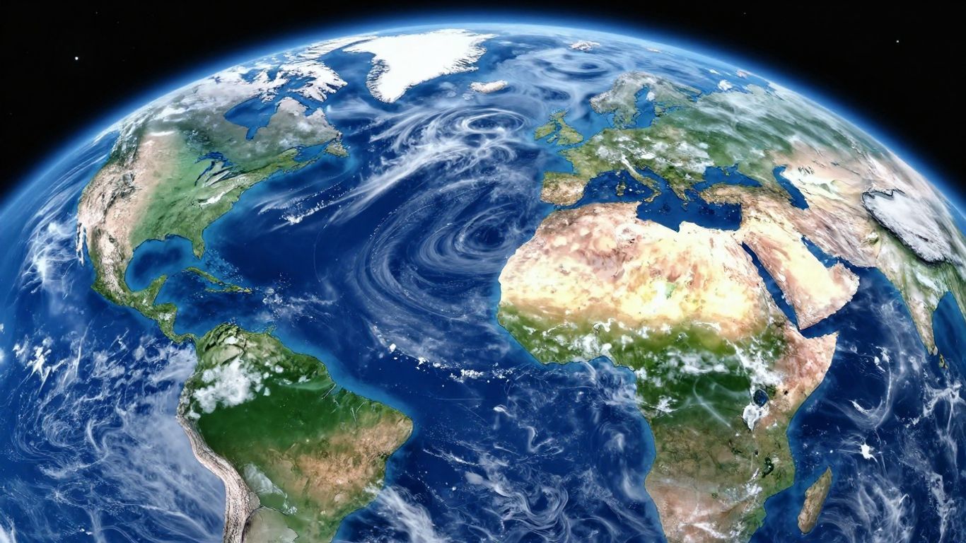
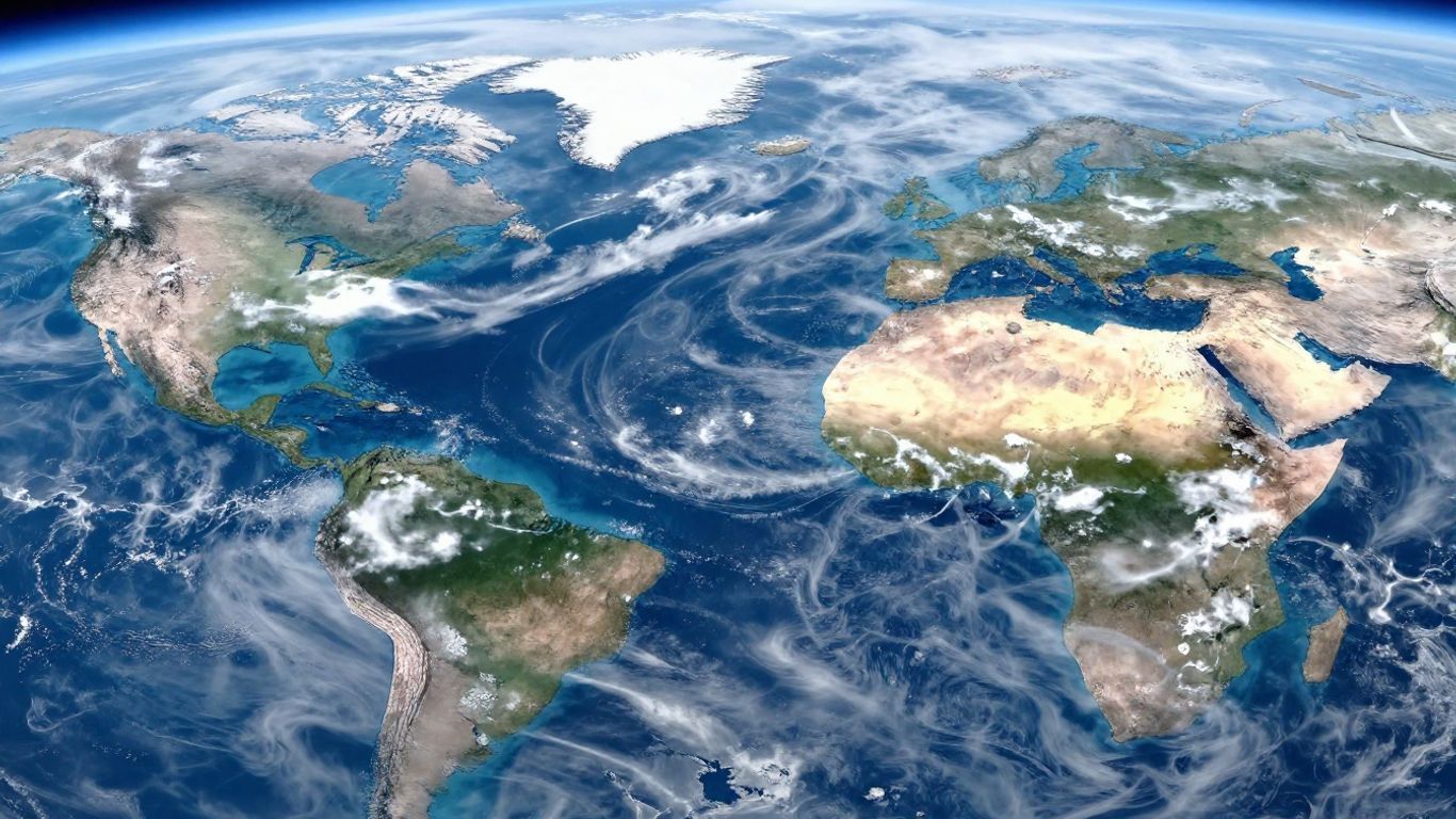
Experience Earth Through Live Satellite Views
Prepare to perceive our planet with an entirely fresh perspective—live satellite views have democratized global exploration, making it an accessible daily pursuit rather than an exclusive domain for scientists and astronauts. Thanks to real-time and high-resolution imagery, anyone can observe dynamic cloud systems forming, marvel at city lights illuminating the night, and even monitor subtle yet significant environmental changes, all conveniently from their smartphone or computer.
High-Resolution Global Imagery
In the modern era, satellite maps offer truly astonishing clarity. Imagine being able to discern everything from extensive highway networks to intricate patchwork farmlands with remarkable precision. So, what exactly can high-resolution imagery enable us to do?
- Effortlessly transition your view from sweeping continental panoramas to specific streets and individual buildings.
- Facilitate direct comparisons between diverse geographical features—forests, lakes, deserts—and sprawling urban areas.
- Monitor evolving weather patterns and rapidly unfolding events in real time.
| Imagery Type | Typical Resolution | Common Uses |
|---|---|---|
| Global Overview | ~1 km / pixel | Tracking weather, climate |
| Urban Detail | <1 m / pixel | Infrastructure, city planning |
| Environmental Changes | Variable | Deforestation, ice melt |
Imagine surveying every corner of the globe, whether by day or night, with just a few effortless clicks—observing nascent storm systems or precisely identifying distant landmarks has truly never been more straightforward.
Real-Time Earth Globe Exploration
Exploring our Earth as an interactive 3D globe extends far beyond mere entertainment; it profoundly enhances one's ability to discern intricate patterns and fundamental connections. Typically, these advanced platforms empower users to:
- Rotate the globe seamlessly, experiencing an authentic planetary perspective.
- Adjust tilt and zoom levels on specific regions to meticulously examine terrain variations or prominent oceanographic features.
- Superimpose current satellite imagery, enabling real-time observation of unfolding global changes.
This offers an exceptionally fluid method for comprehending how disparate geographical locations interlink and how complex weather systems dynamically propagate. You'll readily identify stark differences between day and night, observe seasonal transformations, or even analyze fluctuations in traffic flow during peak holiday periods.
Detailed Landscape and City Views
There's an undeniable allure—a unique fascination, perhaps—in zooming intimately into the heart of a bustling major city or, conversely, a tranquil, remote valley. Suddenly, intricate street layouts, verdant parks, winding rivers, and even grand stadiums snap into sharp focus. Leveraging these highly detailed city and landscape views, you are empowered to:
- Assess patterns of urban expansion or monitor ongoing construction projects.
- Facilitate meticulous trip planning or virtually revisit cherished locations with remarkable fidelity.
- Examine the dynamic interplay between natural environments and human developmental footprints, often in real time.
Many users report finding this experience surprisingly captivating—witnessing the unique morphology of neighborhoods or observing how a majestic mountain range casts its shadows differently throughout the day truly deepens one's appreciation for Earth's inherent complexity.
From the expansive tranquility of open countryside to the intricate tapestry of dense urban grids, live satellite views invariably bring the world into startlingly close proximity—and all, remarkably, without the need for a plane ticket.
Immersive Street-Level Exploration
Navigating Urban Landscapes in 360 Degrees
Have you ever harbored the desire to stroll along a bustling street in Tokyo or delve into the ancient, historic lanes of Rome, all without ever leaving the comfort of your residence? Our innovative platform transforms that aspiration into a tangible reality. Indeed, you can virtually step onto virtually any street, allowing for an encompassing 360-degree panoramic view. This immersive capability truly replicates the sensation of physical presence, bestowing a singular perspective on diverse urban environments across the globe. Consequently, this feature enables you to examine architecture, storefronts, and the prevailing ambiance of a location up close, providing an authentic sense of myriad cities.
Explore Famous Landmarks Virtually
Accessing iconic global landmarks, such as the majestic Eiffel Tower or the awe-inspiring Great Wall of China, is now merely a click away. Our platform offers meticulously detailed, interactive views of these celebrated sites. Users can effortlessly zoom in, pan across their vistas, and genuinely grasp their monumental scale and intricate surroundings. This represents a superb method for delving into history and architecture, or simply for marveling at humanity's profound achievements and the Earth's stunning natural wonders.
Discover Neighborhoods Up Close
Beyond the widely recognized attractions, the platform also extends an invitation to explore more quotidian, everyday neighborhoods. Envision observing the vibrant character of local markets, identifying tranquil residential streets, or simply assessing the distinct ambiance of a specific district. This proves invaluable for individuals meticulously planning a trip, affording them the opportunity to 'feel out' an area well in advance of their arrival, or for those whose curiosity is piqued by the diverse ways people inhabit various corners of the globe. It undeniably provides a more grounded, visceral perspective, contrasting sharply with merely surveying a map from an aerial vantage point.
This extraordinary level of detail truly fosters a more personal, intimate connection with destinations one might otherwise only ever encounter on a screen. In essence, it artfully bridges the often-vast gap between merely observing a map and genuinely experiencing a physical location.
Here's a quick look at what you can do:
- Virtual Pedestrian Journeys: Undertake simulated walks through vibrant city centers and picturesque scenic routes.
- Immersive Landmark Tours: Gain intimate perspectives of celebrated monuments and significant historical sites.
- Authentic Local Insights: Observe the distinct character and vibrancy of both residential areas and commercial districts.
- Comprehensive Planning Aid: Leverage detailed street views to thoroughly familiarize yourself with prospective destinations prior to travel.
Live Feeds and Global Monitoring
Accessing Live Earth Webcams
Have you ever pondered what precisely is transpiring at this very moment in New York's iconic Times Square, or perhaps across the tranquil, sun-drenched beaches of Hawaii? Live Earth webcams offer precisely that—they deliver the immediate world directly to your screen. It’s crucial to understand these are not pre-recorded snippets; rather, they are dynamic, live-streaming video feeds originating from a multitude of global locations. Consequently, you can tune into anything from bustling urban centers to serene natural landscapes, or even observe activity within remote wildlife habitats. This represents an exceptional method for acquiring a real-time understanding of place and witnessing events unfold organically.
Track Weather Systems in Real Time
The intricate science of understanding our planet's weather patterns has become more accessible than at any point in history. Utilizing live satellite imagery, one can meticulously follow the dynamic movement of cloud formations, track the genesis and evolution of storm systems, and precisely observe broader weather patterns as they coalesce and transform. This invaluable data, sourced directly from operational weather satellites, provides an up-to-the-minute, comprehensive perspective on atmospheric conditions. Indeed, it’s akin to possessing a sophisticated global weather station, right at your fingertips.
Here's a look at what you can monitor:
- Comprehensive cloud cover and intricate formations
- Evolutionary storm systems and their predicted trajectories
- Significant meteorological fronts
- Prevailing atmospheric conditions
Monitor Atmospheric Conditions
Moving beyond immediate weather phenomena, live feeds are also capable of furnishing profound insights into broader atmospheric conditions. This encompasses crucial information that helps delineate a clear picture of air quality, alongside other pertinent environmental factors. Through the diligent observation of these critical elements, we can cultivate a much deeper appreciation for the remarkably dynamic and ever-evolving state of our planet's atmosphere.
Observing live feeds emanating from diverse vantage points across Earth truly presents a singular perspective on our planet's ceaseless activity. It inherently connects us not only to our immediate environment but also to the intricate, larger global systems perpetually at play.
Enhance Your Journeys with Smart Tools
Real-Time Traffic Monitoring and Optimized Route Planning
Navigating unfamiliar territories or even familiar routes can often feel like solving a complex puzzle, can't it? Fortunately, this intelligent tool is designed to eliminate much of the guesswork from your journeys. It provides real-time traffic conditions, enabling you to identify potential slowdowns and congestion points even before you embark. This means no more frustrating delays caused by unforeseen traffic jams. You can meticulously plan your optimal route, ensuring the most efficient path to your destination, thereby conserving valuable time and significantly reducing travel-related stress. In essence, it functions as a highly reliable local guide, perpetually directing you toward your desired course.
Integrated Digital Compass Navigation
Occasionally, the most fundamental need is simply to ascertain one's cardinal direction. This application thoughtfully integrates a precise digital compass, designed to furnish accurate navigational guidance. Whether you're embarking on a challenging hike, maneuvering through the intricate streets of an unfamiliar city, or merely attempting to orient yourself in your surroundings, this compass serves as an unwavering aid, helping you consistently remain on course. While seemingly a straightforward utility, its value becomes undeniably immense when exploring new environments.
Speedometer for Travel Monitoring
Maintaining vigilance over one's speed is a crucial aspect of travel, irrespective of whether you are driving, cycling, or even jogging. The integrated speedometer furnishes a clear, real-time display of your current velocity. This proves to be an exceptionally useful mechanism for sustaining awareness of your pace and ensuring adherence to safety protocols and any applicable speed limits.
Here's a quick look at what these tools can do:
- Dynamic Traffic Updates: Access up-to-the-minute road conditions to preemptively circumvent potential delays.
- Optimized Route Finder: Identify the most expedient path to your desired destination.
- Digital Compass: Consistently ascertain your precise bearing.
- Integrated Speedometer: Continuously monitor your travel velocity.
Collectively, these meticulously integrated features collaborate to render your journeys notably smoother and significantly more informed. They deliver genuinely practical information, empowering you to navigate your surroundings with enhanced efficacy.
Discover the World and Beyond
Doesn't it often feel as though the entire world is truly just a few clicks away? Indeed, with today’s sophisticated live Earth maps and advanced exploration tools, you possess the capability to scrutinize not only the thoroughfare directly outside your abode but also to survey a vibrant, bustling market in Bangkok or even glimpse the ethereal Northern Lights. Yet, the utility extends further—these remarkable platforms empower you to transcend terrestrial boundaries, pinpointing nearby points of interest and even peering into the cosmos for captivating celestial events.
Explore Nearby Places and Services
Are you in search of a novel coffee shop, a readily accessible ATM, or perhaps the nearest gas station? Contemporary real-time map applications streamline the process of locating essential services, irrespective of your current geographical position. The 'Nearby Places' feature, in particular, proves to be an indispensable asset when:
- Navigating an unfamiliar city and experiencing culinary needs.
- Requiring prompt access to critical medical services.
- Assessing available lodging options during an extended road trip.
Here's a quick look at handy services you can locate instantly:
| Service | Examples |
|---|---|
| Food & Drink | Cafes, restaurants |
| Finance | ATMs, banks |
| Fuel | Gas stations |
| Health | Hospitals, clinics |
| Lodging | Hotels, motels |
The 'Nearby Places' tool unequivocally helps eliminate the inherent guesswork from both travel and daily life—thereby allowing you to dedicate considerably less time to searching and significantly more time to active exploration.
Understand Global Time Zones Instantly
Have you ever found yourself with a video call meticulously scheduled with an international counterpart, subsequently pondering the precise local time at their location? Or perhaps you've attempted to orchestrate a complex layover in an entirely different country? Fortunately, contemporary real-time Earth maps frequently incorporate an intuitive world time zone tool, considerably simplifying such logistical challenges. With just a few swift taps, you can effortlessly accomplish the following:
- Ascertain the current local time in virtually any global city.
- Visually determine prevailing daylight or nighttime conditions across the globe.
- Facilitate the comfortable scheduling of international meetings or calls.
These integrated world time tools prove particularly invaluable for frequent travelers, remote professionals, or anyone regularly engaging with friends, family, and clients situated in diverse international locales. You can confidently dispense with arduous mental calculations or tedious internet searches for time differences—your sophisticated map application handles it all for you with impeccable accuracy.
Journey Through Space and Celestial Events
One certainly doesn't require the specialized expertise of an astronomer to witness the captivating phenomena unfolding in our skies these days. Many users express genuine surprise upon discovering that their comprehensive Earth map tools also empower them to meticulously track orbiting satellites, access real-time views of the International Space Station, and even monitor upcoming celestial events of significant interest.
Some neat things you can try:
- Receive timely notifications regarding visible meteor showers or anticipated lunar eclipses.
- Monitor the trajectory of forthcoming SpaceX satellite passes overhead.
- Observe live orbital paths and pinpoint the International Space Station's current location.
Even amidst the challenge of cloudy nights or the pervasive light pollution of urban centers, these dynamic live map platforms ingeniously open a virtual window to the cosmos, affording you an unparalleled front-row seat to truly out-of-this-world sights.
Indeed, contemporary Earth map applications extend far beyond merely showcasing the ground beneath your feet—they dramatically pull back the curtain on the entire globe, and further, they graciously invite you to cast your gaze upward, far beyond the confines of our own planet.
Track Planetary Transformations
Observing Historical Landscape Transformations
Our planet is in a state of perpetual flux, and witnessing these profound shifts over extended periods can be quite revelatory. Utilizing this sophisticated tool, one can retrospectively examine satellite imagery spanning various years. This capability is akin to possessing a geographical time machine, wouldn't you agree? You can observe how coastlines have subtly migrated, how forest coverage has expanded or receded, and even how arid deserts have steadily encroached upon new territories. Ultimately, this functionality significantly deepens our appreciation for the extraordinarily dynamic nature of Earth's surface.
Monitor Urban Development Over Time
Cities, of course, do not simply materialize; rather, they evolve and expand organically. This particular feature allows you to meticulously observe that very growth in action. Envision tracing the transformation of modest towns into sprawling metropolises, documenting the construction of extensive new roadways, and charting the incremental development of neighborhoods over several decades. It is undeniably fascinating to witness the enduring impact of human endeavor on the natural and built landscape.
Analyze Environmental Shifts
Beyond the scope of urban centers and general landscapes, we are also empowered to track more expansive, significant environmental transformations. This comprehensive monitoring encompasses phenomena such as:
- Observable glacier melt and the progressive reduction of polar ice caps.
- Fluctuations in vegetation cover attributable to evolving climate patterns or changes in land use.
- The long-term impact of significant natural events, including devastating floods or pronounced volcanic activity.
Understanding these profound transformations extends far beyond merely appreciating aesthetically pleasing imagery. Fundamentally, it involves the meticulous aggregation of crucial information that can, in turn, guide us toward making more informed and sustainable decisions for the future stewardship of our planet. When the evidence is presented visually, the underlying data invariably resonates with a much greater sense of reality and urgency.
Ultimately, it represents a profoundly powerful means of connecting with the enduring and ever-unfolding narrative of our world.
Your Window to the World
And so, there you have it—a comprehensive overview of this extraordinary live Earth map experience, which undeniably places our magnificent planet directly at your fingertips. From observing dynamic weather patterns unfolding across continents to virtually strolling down a charming street in a city you've only ever dreamt of visiting, it is truly astounding what capabilities are now at our disposal. Yet, its utility transcends mere visual engagement; it's not solely about admiring captivating imagery. The ability to promptly locate nearby services or even precisely monitor your speed during a leisurely bike ride elevates it to an eminently practical tool as well. Consider it your personal, perpetual passport to anywhere, at any time. It offers an elegantly simple, yet profoundly engaging, method for cultivating an enduring curiosity about the world around us—and frankly, witnessing it all unfold in real time is, quite simply, an awe-inspiring experience.
Frequently Asked Questions
What can I see with this live Earth map?
With this live Earth map, you gain access to exceptionally detailed, real-time satellite imagery of our entire planet. Imagine, if you will, observing Earth from a celestial vantage point! You can seamlessly zoom in to explore cities, towns, majestic mountains, and vast oceans in stunning proximity. Furthermore, it empowers you to engage in immersive 360-degree street views, allowing you to virtually navigate iconic landmarks or even your own local neighborhood.
How does the street-level exploration work?
The street-level exploration feature is remarkably intuitive. Envision visiting virtually any street across the globe, all from the comfort of your home; the street-level view makes this a vibrant reality! You are empowered to virtually traverse, survey your surroundings in every direction, and thus gain an authentic, tangible feel for a location—almost as if you were physically present. This is particularly advantageous for scouting celebrated landmarks or simply experiencing the unique character of a new city.
Can I see live events happening on Earth?
Indeed, absolutely! The application integrates a diverse network of live webcams strategically positioned across the globe. This functionality allows you to observe current events unfolding in various cities, witness natural wonders in real time, or even meticulously track evolving weather patterns. It represents an unparalleled method for connecting with the world as it happens, fostering an immediate sense of global awareness.
Does it help with planning trips or daily travel?
Unquestionably! This platform is equipped with an array of smart tools designed to assist significantly with both trip planning and everyday travel. For instance, a live traffic map aids in identifying the most expedient routes while expertly circumventing potential congestion. Additionally, a built-in compass ensures you remain oriented, and an integrated speedometer allows for precise monitoring of your travel velocity. Essentially, it functions as a highly competent personal travel assistant, readily available in your pocket.
What if I want to explore beyond Earth?
Certainly, the exploration doesn't cease at our planet's atmosphere! The application also extends an invitation to peer into the cosmos. You can delve into fascinating insights about distant planets, shimmering stars, and other compelling phenomena occurring within the universe. It presents an engaging and enjoyable avenue for comprehending the dynamic happenings far beyond the confines of Earth.
Can I see how places have changed over time?
Yes, this is an absolutely core feature! The platform provides a unique historical perspective, showcasing how both natural landscapes and urban areas have evolved over many years, utilizing archival satellite imagery. This capability enables you to visualize phenomena such as the growth of cities or the notable shifts in the environment. It serves as an invaluable means for understanding our planet's rich history and its continuous, fascinating transformations.


