
resources
Navigating New York: A Comprehensive Guide to Cities and Their Zip Codes
26 Feb 2026

New York—it's undeniably a vast and intricate place, and figuring out where everything is can certainly feel like solving a complex puzzle. Most of us are familiar with the famous landmarks, but what about the everyday necessities—like ensuring mail delivery or finding a specific street? This is precisely where zip codes become indispensable. Think of them as unique identifiers for different areas, essential for everything to run smoothly. This comprehensive guide delves into understanding these vital codes across New York State, encompassing everything from the bustling thoroughfares of New York City to the serene communities upstate. We'll meticulously break down how they function and why they hold such significance in our daily lives.
Key Takeaways
- Zip codes play a crucial role in facilitating efficient mail and package delivery, as well as aiding general navigation throughout New York's diverse cities and towns.
- Manhattan, in particular, features an intricate zip code system that closely corresponds to its numerous distinct neighborhoods.
- Beyond Manhattan, New York City's other boroughs—including Brooklyn, the Bronx, Queens, and Staten Island—each possess their own specific zip code layouts, reflecting their unique geographies.
- Major upstate cities, such as Albany, Buffalo, and Syracuse, are defined by their distinct sets of zip codes, helping to delineate their respective areas.
- Leveraging online tools and digital maps can help you effortlessly pinpoint the correct zip code for any address in New York, thereby ensuring greater accuracy for deliveries and travel plans.
Understanding New York City Zip Codes
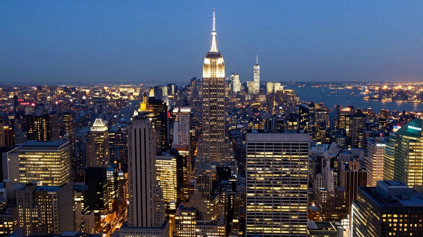
New York City isn’t merely a sprawling metropolis; it’s a vibrant patchwork of neighborhoods, each intricately stitched together by its own zip code. These five-digit numerical sequences do far more than simply help mail reach its destination—they fundamentally shape how people locate places, discuss their city, and conduct business. A solid grasp of how zip codes operate in New York can significantly streamline your experience, whether you're a long-time resident or just visiting.
The Importance of Zip Codes in New York
In New York City, a zip code transcends its primary function of directing packages. It plays a pivotal role in defining local identity and influences a wide array of aspects, from service availability to demographic patterns. Here’s why these seemingly simple codes hold such weight in the city:
- They assist in identifying neighborhood boundaries, which, interestingly enough, can sometimes shift over time.
- Businesses frequently utilize them to tailor their services and offerings to specific locales.
- Zip codes can even impact seemingly disparate elements, such as car insurance rates and school assignments.
- They are absolutely essential for tasks like connecting utilities or reporting city issues through online platforms.
Navigating Neighborhoods with Zip Codes
Given the sheer number of neighborhoods often condensed into a single borough, zip codes serve as a vital navigational aid, helping individuals pinpoint their exact destination—be it for work, leisure, or a social call. Wondering where the East Village seamlessly transitions into Alphabet City? A quick glance at a zip code map is often your most reliable starting point.
- While many neighborhoods may share a zip code, certain areas, particularly in Lower Manhattan, are characterized by multiple codes within a compact expanse.
- Street addresses don't always align perfectly within a single zip code, especially when situated along boundary lines.
- Fortunately, online tools and official city maps are readily available to help residents and visitors quickly find the correct code.
If you ever find yourself a bit disoriented or struggling to determine your precise neighborhood, simply plug the address or cross street into a zip code lookup tool—chances are, it will clarify things in an instant.
Efficient Mail and Package Delivery
The original — and undeniably straightforward — purpose of zip codes was to ensure mail reached its intended recipient, and fast. In a city as densely populated as New York, this is no small feat. Accurate zip codes significantly contribute to:
- The effective sorting and routing of mail and packages to the appropriate post offices.
- Expedited delivery times for both businesses and individual residents.
- A noticeable reduction in lost or delayed shipments, particularly within high-density residential and commercial buildings.
Here’s a snapshot illustrating how just a few central Manhattan neighborhoods are meticulously delineated by zip code:
| Neighborhood | Example Zip Code(s) |
|---|---|
| Financial District | 10004, 10005, 10006 |
| Chelsea | 10001, 10011 |
| Harlem | 10026, 10027 |
| East Village | 10003, 10009 |
Of course, not all cities are as tightly segmented as NYC—but when you possess the correct zip code, your mail, your taxi, or even your dinner delivery is far more likely to arrive precisely where and when you expect it.
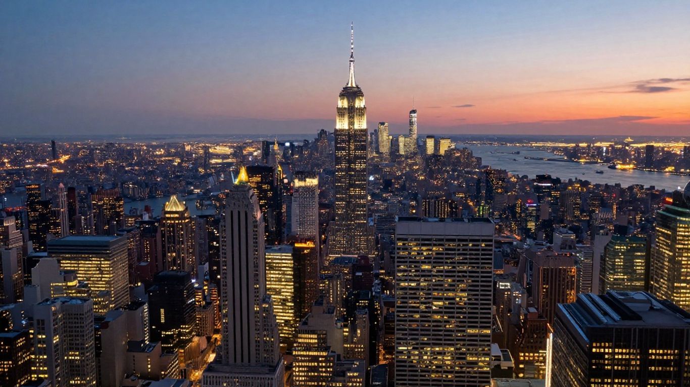
Manhattan's Diverse Zip Code Landscape
Manhattan, the iconic island that so often springs to mind when one thinks of New York City, boasts a zip code map as varied and dynamic as its world-famous skyline. It's truly not just one monolithic area; rather, it’s a captivating collection of distinct neighborhoods, each assigned its own postal code—or, in some cases, a cluster of them. This makes the simple act of sending mail or locating a specific address feel a bit like a treasure hunt at first, though with a little practice, it quickly becomes second nature.
Financial District and Civic Center Zip Codes
Nestled at Manhattan's southern tip, you'll discover the perpetually bustling Financial District and the Civic Center. This dynamic area serves as the city's economic heartbeat, home to both Wall Street and numerous government buildings. The zip codes here are notably concentrated, a clear reflection of the intense business activity that permeates the district.
- 10004: Primarily encompasses areas such as Battery Park and specific segments of the Financial District.
- 10005: Covers a substantial portion of the Financial District, notably including the venerable New York Stock Exchange.
- 10006: Also serves the Financial District, often extending to areas surrounding Federal Hall.
- 10007: This code is designated for the Civic Center, incorporating City Hall and various courthouses, alongside portions of Tribeca.
- 10038: Includes vibrant areas like the South Street Seaport and additional parts of the Financial District.
These specific codes are absolutely essential for anyone engaging with financial institutions, legal services, or governmental offices situated within this historic part of the city.
Midtown East and West Zip Codes
Venturing northward, Midtown emerges as a colossal hub of commerce, entertainment, and truly iconic landmarks, from Times Square to the United Nations. The zip codes here are quite expansive, designed to cover a broad spectrum of businesses and residential properties.
- Midtown East: Generally falls within 10017 (home to the majestic Grand Central Terminal and the UN Headquarters) and 10022 (encompassing upscale Fifth Avenue shopping and segments of the Upper East Side that subtly blend into Midtown).
- Midtown West: This encompasses 10018 (around Penn Station and the historic Garment District), 10019 (the vibrant Times Square, numerous Broadway theaters, and Rockefeller Center), and 10036 (also covering portions of the Theater District and the lively Hell's Kitchen).
Upper East and West Side Zip Codes
These two renowned residential enclaves, elegantly separated by the verdant expanse of Central Park, each possess their own distinct postal zones. They are celebrated for their charming brownstones, world-class museums, and beautiful parks.
- Upper East Side: Primarily covered by 10021, 10028, and 10075, with 10044 and 10128 also serving specific sections. These codes stretch from the eastern border of Central Park up towards Harlem.
- Upper West Side: You'll typically find these distinguished areas within 10023, 10024, and 10025, encompassing neighborhoods from the western edge of Central Park up to Morningside Heights.
Downtown Neighborhoods and Their Zip Codes
Downtown Manhattan is a fascinating tapestry of vibrant, historic, and undeniably trendy neighborhoods, each imbued with its own unique character and corresponding zip codes.
- SoHo & NoHo: Revered for their distinctive cast-iron architecture and premier shopping, these areas are predominantly found within 10012 and 10013.
- Greenwich Village & West Village: These charming, bohemian neighborhoods are largely covered by 10014 and 10012.
- Lower East Side & East Village: Areas rich in immigrant history and famed for their dynamic nightlife, these fall into 10002 (Lower East Side) and 10003, 10009 (East Village).
- Tribeca: Celebrated for its expansive lofts and picturesque cobblestone streets, Tribeca is largely situated within 10007 and 10013.
- Chinatown & Little Italy: These culturally rich districts share 10013 and 10002.
A firm understanding of these distinct zones proves invaluable for everything from sending a simple letter to meticulously planning a visit, ultimately making Manhattan's intricate geography a good deal easier to navigate.
Exploring Other New York City Boroughs
Beyond the instantly recognizable skyline of Manhattan, New York City is a rich tapestry woven from five distinct boroughs, each possessing its own unique character and, naturally, its own postal geography. Understanding the zip codes across these areas helps paint a much clearer picture of their incredible diversity.
Brooklyn's Zip Code Distribution
Brooklyn, a borough renowned for its vibrant neighborhoods and deep historical roots, features a complex zip code system that often reflects its many distinct communities. While official boundaries can, at times, be rather fluid, zip codes undeniably offer a practical method for mapping these diverse areas. For instance, locales such as Williamsburg and Greenpoint, separated by major thoroughfares like the Brooklyn-Queens Expressway, each maintain their own specific postal zones. Further south, neighborhoods including Bay Ridge and Red Hook are also defined by their unique codes, collectively contributing to the borough's intricate postal map.
The Bronx and Its Postal Zones
The Bronx, uniquely positioned as the only part of New York City on the mainland, is meticulously divided into several postal zones. These zip codes are instrumental in delineating areas, ranging from its bustling commercial districts to its quieter, more residential streets. The Morris Park Avenue area, for example, is well-known for its strong community presence, with specific zip codes serving its residents and businesses alike. Grasping these zones is truly key to recognizing the varied components that make up this distinctive borough.
Queens Neighborhoods and Zip Codes
As New York City's largest borough by land area, Queens boasts an astonishingly diverse population and, consequently, an impressive variety of zip codes. From the energetic streets of Jackson Heights and Astoria in the west to the more suburban tranquility of Forest Hills in the east, every area is covered by specific zip codes. These codes aren't merely for mail; they actively help define the boundaries of communities that might otherwise blend together given the borough's sheer vastness.
Staten Island's Postal Geography
Staten Island, frequently referred to as the "Borough of Parks," offers a noticeably more spread-out atmosphere compared to its urban counterparts. Its zip codes reflect this characteristic, encompassing a diverse mix of residential areas, natural landscapes, and commercial centers. The North Shore, for example, has a distinct set of postal codes different from the more southern parts of the island. Mapping these zip codes truly provides an excellent overview of Staten Island's layout and its unique communities.
It's important to remember that neighborhood names and their perceived boundaries can sometimes be a lively point of discussion among residents. While zip codes offer a standardized system for efficient mail delivery and geographic reference, the true "feel" of a neighborhood can often extend well beyond its official postal code. Many areas possess overlapping identities, and what one person confidently calls a neighborhood, another might perceive as part of a larger or even an entirely different area.
Zip Codes for Cities Beyond New York City
While New York City often garners the lion's share of attention, the rest of New York State is teeming with vibrant cities, each boasting its own critical set of postal codes. Understanding these can prove incredibly helpful, whether you're meticulously planning a road trip, sending a package upstate, or simply curious about the state's intricate geography. Let's delve into some of the major regions and their defining codes.
Albany and the Capital Region Zip Codes
Albany, serving as the state capital, along with its surrounding areas, collectively forms the Capital Region. This expansive region includes prominent cities like Schenectady, Troy, and Saratoga Springs. Each city, and even specific neighborhoods within them, possesses unique zip codes. For instance, Albany itself features several zip codes, generally falling within the 122xx range, though the precise code, of course, hinges on the exact location. Specialized maps and atlases dedicated to this region often meticulously break down these postal zones, illustrating how they align with streets and local landmarks.
Buffalo and Niagara Falls Postal Codes
Western New York is famously home to Buffalo and the awe-inspiring Niagara Falls. Buffalo's zip codes primarily reside within the 142xx range. Niagara Falls, NY, conversely, utilizes zip codes beginning with 143xx. These areas, much like many others, have experienced changes and expansions in their postal zones over time. Detailed street maps for this captivating region are an excellent resource for visualizing how these codes are laid out, particularly around popular tourist attractions and established residential neighborhoods.
Syracuse and Central New York Zip Codes
Central New York is anchored by Syracuse, a city well-known for its prominent university and strategic central location. Syracuse zip codes typically commence with 132xx. Nearby cities and towns in the area also maintain their own distinct codes. Utica, for example, situated a bit further east, uses codes within the 135xx range. Grasping these codes significantly assists in pinpointing precise locations for deliveries or navigating travel within this vital part of the state.
Other Upstate Cities and Their Zip Codes
New York State is dotted with numerous other notable cities, each with its own postal identity. Consider Rochester, with zip codes often falling within the 146xx range, or Binghamton in the picturesque Southern Tier, typically using codes like 139xx. Even smaller cities and towns across the state have their designated zip codes, which are absolutely essential for efficient mail services and robust logistics. Many local street maps and atlases are readily available, often detailing these specific areas and listing zip codes alongside street names and key points of interest.
It's important to remember that zip codes are dynamic entities. While they generally remain consistent, postal services do update boundaries and codes as areas experience growth or other changes. Always double-check with official sources if you require the most current information for a specific address—it's always better to be safe than sorry.
Here's a quick reference to some common starting digits for zip codes in these distinct regions:
- Capital Region (Albany area): Often starts with 12
- Western New York (Buffalo/Niagara Falls): Often starts with 14
- Central New York (Syracuse area): Often starts with 132 (Syracuse) or 135 (Utica)
- Southern Tier (Binghamton area): Often starts with 139
- Rochester area: Often starts with 146
Utilizing Zip Codes for Navigation and Services
Getting around New York State, whether you're in the bustling city or a tranquil upstate town, becomes considerably easier once you grasp how zip codes fit into the picture. These five-digit sequences are much more than mere numbers for mail—they actually form the fundamental backbone for a multitude of day-to-day services, helping both individuals and companies ensure things get precisely where they need to be. Here’s a closer look at how zip codes are invaluable for finding addresses, streamlining trip planning, and guaranteeing your packages arrive at the correct destination.
Finding the Right Zip Code for an Address
Sometimes, a street address simply isn't enough, particularly in large apartment buildings or neighborhoods that might straddle more than one zip code. So, how do you track down the correct one?
- Utilize the official USPS Zip Code Lookup tool online. Just type in the address, and it will provide the exact zip code.
- Consult your building’s management or review your lease paperwork—it's worth noting that zip codes can occasionally change or split over time.
- City websites and popular commercial tools (such as Google Maps) typically display zip code boundaries on their interactive maps.
An accurate zip code not only accelerates deliveries but also effectively prevents confusion, especially in dense urban environments like New York City or in suburban areas featuring similar street names.
Using Zip Codes for Travel Planning
Believe it or not, possessing knowledge of zip codes can genuinely enhance your travel planning, whether you’re booking a hotel, arranging a visit, or even hailing a rideshare. Wondering how they help with travel planning? They're more useful than you might think!
- Hotels and rental listings often organize properties by zip code for convenient reference and searching.
- Certain restaurants or attractions integrate zip codes into their online booking or delivery setup.
- Zip codes enable you to easily compare driving distances, assess rideshare pricing, or even check localized weather forecasts for specific areas.
| Zip Code | Neighborhood/City | Use Case (Example) |
|---|---|---|
| 10003 | East Village, Manhattan | Book a hotel |
| 11201 | Brooklyn Heights | Order food delivery |
| 14604 | Downtown Rochester | Plan a sightseeing route |
Ensuring Accurate Deliveries with Zip Codes
There’s perhaps nothing quite as frustrating as a package that goes astray due to an incorrect zip code. Here are a few invaluable tips to ensure your mail and shipments consistently reach the right destination:
- Always double-check addresses meticulously before placing an order or dispatching anything.
- If you're relocating, promptly update your zip code with banks, subscription services, and the DMV.
- For larger buildings, it's wise to know if there’s a unique zip code specifically assigned to your complex, particularly in places like Manhattan.
A properly used zip code translates to fewer delays, more satisfied customers, and significantly less time spent tracking down lost packages—a win-win for everyone involved.
When you pay close attention to zip codes across New York, it demonstrably saves time, prevents unnecessary headaches, and keeps your plans progressing smoothly, whether you’re a long-term resident, an eager traveler, or simply sending a birthday card to a cherished friend.
Resources for New York Zip Code Information
Finding the right zip code can, at times, feel a bit like a treasure hunt, especially in a place as geographically vast and intricate as New York. Fortunately, there's an abundance of effective tools and reliable resources available to help you pinpoint the exact postal code you need. Whether you're sending a letter, meticulously planning a trip, or simply curious about a particular area, these resources can genuinely simplify the entire process.
Online Zip Code Lookup Tools
These undoubtedly stand out as the quickest and most straightforward methods for finding a zip code. Most are completely free to use and can provide accurate results in mere seconds. Typically, you'll just need to enter an address, a city, or even just a street name, and the tool will efficiently handle the rest. It’s always a good idea to bookmark a couple of your preferred options for future convenience.
- USPS Zip Code Lookup: This is the official and most authoritative source directly from the United States Postal Service. It's consistently reliable and covers all addresses nationwide.
- Other Online Map Services: Many popular mapping websites have seamlessly integrated zip code search functions. These can be particularly handy if you’re already using them for navigation or directions.
- Third-Party Zip Code Websites: Numerous specialized websites focus exclusively on zip code information, often providing valuable supplementary details like demographics or specific area statistics.
New York Zip Code Maps and Atlases
For those who prefer a more visual approach, especially when trying to grasp the geographical distribution of zip codes, traditional maps and atlases are absolutely fantastic. These resources can clearly illustrate how zip codes are laid out across various neighborhoods and cities, which proves incredibly helpful for planning or simply gaining a better feel for an area’s layout.
- Street Atlases: These are comprehensive books filled with detailed maps. Many are specifically tailored to cover particular regions of New York, such as the Capital Region, Buffalo, or even the entire state. They often clearly mark zip code boundaries.
- Wall Maps: If you require a broader, more expansive view, large wall maps depicting New York City or specific counties can be a superb addition to an office or study space. They frequently highlight major roads, cities, and, of course, zip codes.
- Online Interactive Maps: Many websites offer dynamic interactive maps where you can effortlessly zoom in and out, click on specific areas, and instantly view the corresponding zip codes. These deftly combine the meticulous detail of an atlas with the inherent convenience of online tools.
Understanding Postal Zone Boundaries
Sometimes, simply knowing the numbers isn't quite enough. A deeper understanding of how postal zones are defined can truly help you comprehend why certain areas have specific zip codes, or why a single code might encompass a surprisingly large—or indeed, a very small—area. Postal services meticulously create these zones with the primary goal of making mail delivery as efficient as possible. Factors such as population density, distinctive geographic features, and the sheer volume of mail can all significantly influence how these boundaries are ultimately drawn.
It's worth remembering that zip codes aren't always perfectly aligned with traditional neighborhood boundaries. Occasionally, a single zip code might encompass several distinct neighborhoods, or conversely, a large neighborhood might find itself split across multiple zip codes. This nuanced system is all an integral part of the design, fundamentally aimed at ensuring the most efficient mail sorting and delivery possible.
Wrapping Up Your New York City Zip Code Journey
So, we've taken a comprehensive look at how New York City's zip codes operate, with a particular focus on Manhattan. It turns out these unassuming codes are truly far more than just numbers on an envelope. They serve as crucial indicators, pointing to the distinct areas and the unique character of each neighborhood. Whether you're trying to send a package, meticulously plan a visit, or simply orient yourself, knowing the right zip code makes life in this bustling metropolis—or anywhere in New York State—a good deal simpler. Consider them your little keys to unlocking seamless navigation within this expansive city. Keep this valuable information handy, and you'll undoubtedly be moving around New York like a seasoned pro.
Frequently Asked Questions
Why does New York City have so many different zip codes?
New York City is an exceptionally vast place, brimming with an incredible array of distinct neighborhoods, each possessing its own unique atmosphere. Having numerous zip codes is fundamentally a logistical solution; it allows the postal service to sort and deliver mail swiftly and accurately to each specific area, accommodating the city's immense diversity and density.
How can I find the zip code for a specific address in New York?
The most straightforward method is to utilize online tools, such as the official USPS website's lookup function. Additionally, you can consult detailed maps of New York City that explicitly illustrate zip codes for different areas—these are quite helpful for visual learners.
What's the best way to make sure a package or letter gets to the right place in New York?
Always, without fail, double-check both the address and the zip code before dispatching anything. Getting the zip code precisely correct is absolutely paramount for ensuring your mail or package arrives punctually and without any inconvenient mix-ups.
Are New York zip codes always just numbers?
Yes, within the United States, standard zip codes are invariably composed of five numerical digits. Occasionally, an additional four-digit code, known as the ZIP+4, may be appended to the end for even more granular and specific delivery details.
Can I use zip codes to help me get around New York City?
Absolutely! Zip codes can provide you with a valuable general sense of your current location or your intended destination. They are instrumental in mapping out neighborhood boundaries and can prove quite useful when planning trips or utilizing various navigation applications.
Where can I find a map of New York City zip codes?
You'll find a plethora of New York City zip code maps readily available online. These maps are exceptionally beneficial for visualizing how the myriad different zip codes are distributed across the city's many, diverse neighborhoods.


