
resources
Exploring Ohio Cities: A Comprehensive Guide to Municipalities and Populations in 2026
10 Jan 2026

Ohio's diverse cities offer a truly fascinating tableau, ranging from bustling urban centers to serene, smaller towns. Each locality, without exception, possesses its own distinct character and attracts a unique populace. In this exploration, we'll delve into the intricacies of what makes these Ohio cities thrive, examine their population dynamics, and uncover the elements that contribute to their individual uniqueness. Given its considerable size and array of communities, gaining an understanding of these varied locales invariably provides a clearer, more nuanced picture of Ohio itself.
Key Takeaways
- Ohio boasts a remarkable variety of places to call home, from expansive cities to charming small villages, each adding its own special flavor to the state's fabric.
- Prominent urban centers like Columbus, Cleveland, and Cincinnati stand as pivotal hubs for employment, cultural enrichment, and industrial activity.
- For analytical purposes, the state is delineated into distinct regions, encompassing both large metropolitan areas and smaller micropolitan ones.
- The population figures across Ohio's cities demonstrate significant fluctuation; some are experiencing notable growth, while others maintain a more stable demographic.
- A grasp of how cities and villages are formally structured is essential for comprehending the operational dynamics of these diverse communities.
Understanding Ohio Cities: An Overview
Ohio, a state rich in activity, presents a captivating spectrum, from its expansive cities to its charming, diminutive towns. Indeed, it's far from a monolithic entity; rather, it’s a vibrant tapestry woven from countless threads. We proudly feature major hubs such as Cleveland and Columbus, alongside an array of smaller communities that are equally instrumental in the state's overall functionality. This comprehensive guide aims to illuminate these distinct locales, unraveling what propels them forward and detailing their population counts as we approach 2026.
Defining Municipalities in Ohio
When we refer to "municipalities" within Ohio, we are essentially discussing formally organized local governments. This designation can encompass several distinct types of entities. Primarily, you have cities, which are generally larger in population and offer a more extensive range of public services. Conversely, villages are typically smaller, often with a more circumscribed set of governmental responsibilities. Understanding this distinction is quite important, as it directly influences the administration of local affairs. Crucially, the legal definitions and classifications for these various places are meticulously established by the state legislature.
To provide a clearer picture, here’s a concise breakdown:
- Cities: These typically command a larger population base and are vested with more extensive governmental powers.
- Villages: Characterized by smaller populations, they often operate with a more limited scope of services.
- Townships: Distinct from both cities and villages, townships function as subdivisions of counties, possessing their own specific responsibilities, frequently overseeing more rural territories.
Key Characteristics of Ohio Municipalities
What truly distinguishes an Ohio city or town? It's a confluence of various elements. There are, of course, the readily apparent factors, such as population density and the local economic landscape. Yet, it also deeply involves the historical narrative, the prevailing cultural ethos, and the array of available public services. Some cities are renowned for their industrial prowess, while others might be celebrated for their esteemed universities or vibrant arts scenes. The organizational structure they adopt—their specific form of government and the services they choose to provide—also plays a profoundly significant role in their overall identity and functionality.
Ohio's urban areas are remarkably well-integrated. The state boasts an extensive highway system, which proves invaluable for the efficient movement of both people and goods. This connectivity means that a substantial portion of North America is within easy reach, a considerable advantage for businesses and, frankly, for simply getting around.
The Role of Cities and Villages
Both cities and villages inherently fulfill vital roles within the state's broader framework. Larger cities frequently emerge as central hubs for employment opportunities, cultural immersion, and transportation networks. They act as veritable magnets, attracting people and serving as powerful economic engines. Smaller villages, however, often embody the very heart of their local communities. They might function as agricultural centers, charming tourist destinations, or simply tranquil locales where generations have built their lives. Their contributions to Ohio's unique character are distinct from what larger cities offer—and it is precisely this rich variety that makes Ohio such an engaging place to explore.
Exploring Ohio's Diverse Cities
Ohio's cities collectively present a fascinating mosaic, with each contributing its unique character and indispensable qualities to the state's overarching identity. From the pivotal urban centers that buttress our economy to the smaller, more intimate communities that impart Ohio its distinctive charm, there's an abundance to uncover. It's not merely a question of population figures; rather, it's about understanding the unique pulse that animates each individual city.
Cities Anchoring Metropolitan Areas
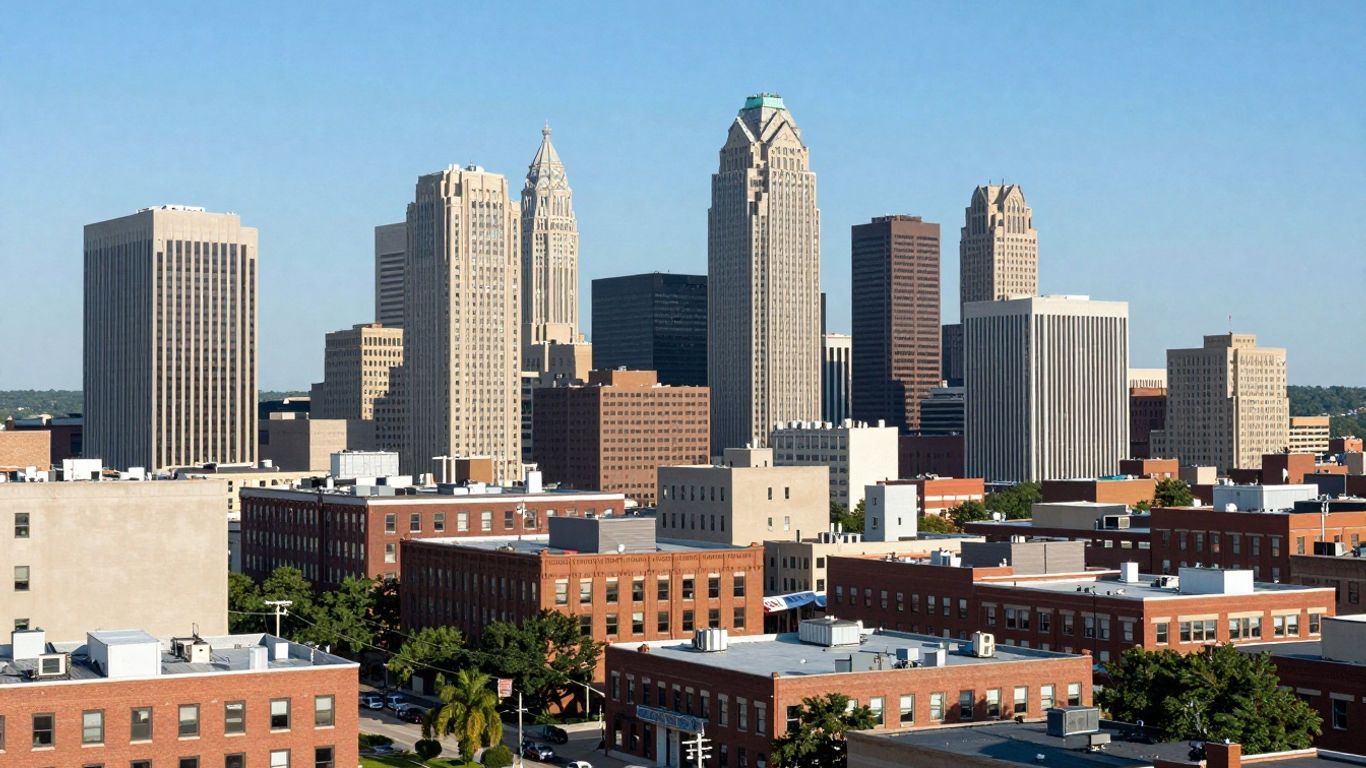
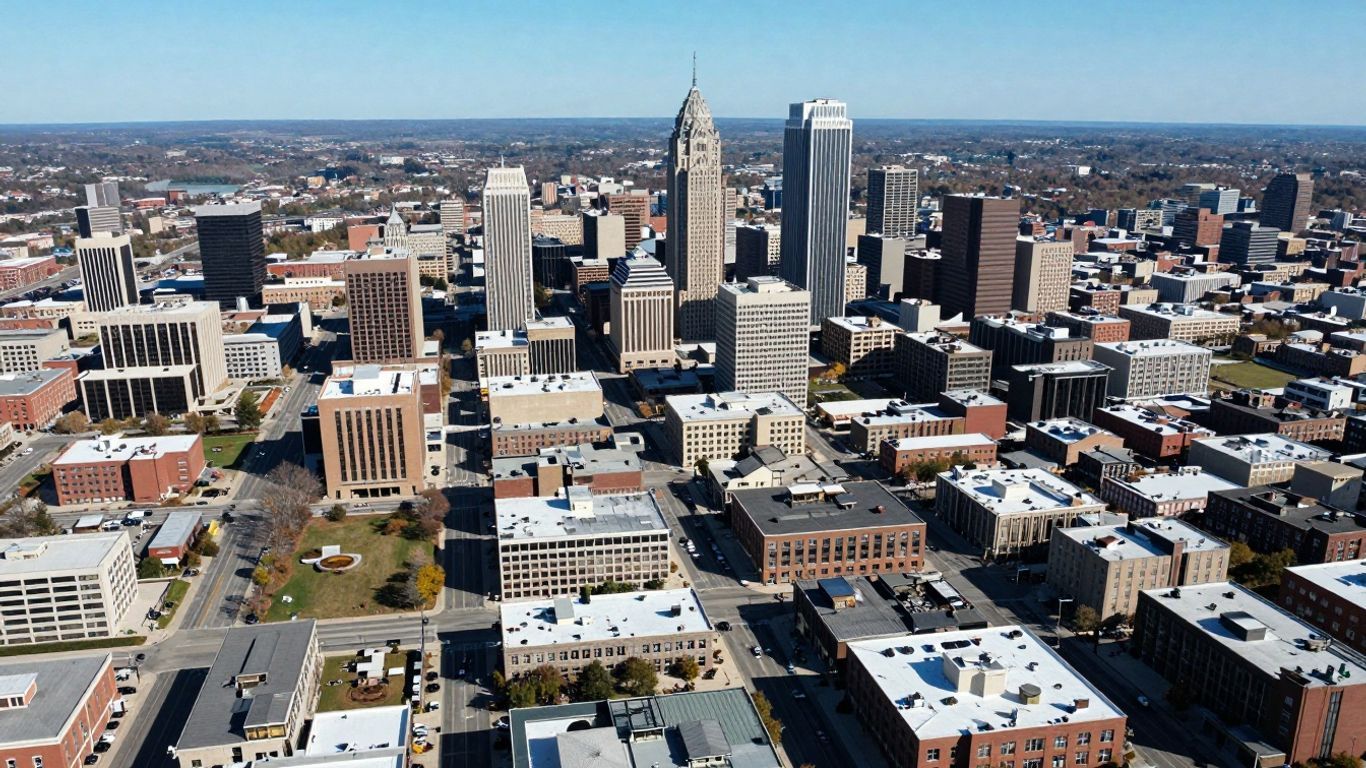
These are, without doubt, the major players—the cities that instinctively come to mind when one visualizes Ohio's urban expanse: Columbus, Cleveland, and Cincinnati. They function as powerful magnets, drawing individuals seeking employment, educational pursuits, and enriching cultural experiences. These cities frequently host prominent corporations, esteemed universities, and critical medical facilities. Moreover, they serve as crucial nodes within Ohio's intricate transportation network, effectively linking the state to the wider nation.
The Role of Smaller Cities in Ohio's Fabric
One should never underestimate the profound importance of Ohio's smaller cities and towns. They often form the very heart of their respective counties, offering a distinct rhythm of life and fostering unique local economies, perhaps centered on agriculture or specialized manufacturing. Many individuals consciously choose these locales to establish roots and raise families, thereby cultivating a robust sense of community. These towns might be celebrated for a particular local festival, a significant historical site, or a natural resource that drives their economy. Their inherent value is not solely measured by population size, but rather by the quality of life and the unwavering community spirit they so generously provide.
Geographic Distribution of Ohio's Population Centers
Ohio's population is far from uniformly distributed across its landscape. One will observe the highest concentrations of residents clustered around the principal metropolitan areas, namely Cleveland, Columbus, and Cincinnati. These cities operate as the primary hubs for their surrounding regions. Smaller cities and towns, conversely, are dispersed throughout the state, often fulfilling specific local needs or possessing deep historical significance. This prevailing pattern is a direct consequence of Ohio's industrial heritage, its agricultural foundations, and the more recent expansion of newer industries within its larger cities.
The manner in which people are distributed across Ohio vividly narrates the story of the state's history and its economic evolution. Major cities flourished around industry and vital transportation routes, while smaller towns frequently developed around agricultural pursuits or specific local resources. This distribution continues its dynamic evolution as the broader economy undergoes its own transformations.
Major Metropolitan Hubs of Ohio
Ohio proudly showcases several sprawling urban centers that serve as primary catalysts for business, culture, and population density. These major metropolitan areas are, in essence, the powerful engines propelling much of the state's economy and meticulously shaping its unique identity. Let's now take a more in-depth look at some of the most significant among them—each a hub of activity and innovation.
Cleveland-Elyria-Mentor Metropolitan Statistical Area
Centered gracefully around the city of Cleveland on the southern shore of Lake Erie, this area functions as a formidable economic and cultural hub for Northeast Ohio. Though historically celebrated for its industrial might, the region has remarkably diversified, now boasting considerable strengths in healthcare, finance, and advanced manufacturing. The Cleveland-Elyria-Mentor MSA thoughtfully encompasses Cuyahoga County and several adjacent counties, vividly reflecting the broad influence exerted by the city.
Cincinnati-Middletown-Wilmington Metropolitan Statistical Area
This expansive region truly stretches across southwestern Ohio and extends into contiguous parts of Kentucky and Indiana, thereby forming a vital economic zone alongside the historic Ohio River. Cincinnati itself stands as a dynamic hub for finance, technology, and consumer goods. The MSA comprehensively includes a wide array of communities, underscoring the intricate interconnectedness of urban and suburban life in this particular quadrant of the state.
Columbus-Marion-Chillicothe Combined Statistical Area
As both the distinguished state capital and its most populous city, Columbus firmly anchors this notably large and consistently growing area. Conveniently situated near Ohio's precise geographic center, Columbus is undeniably a powerhouse for business, education, and technology—a prominence significantly bolstered by the presence of Ohio State University. This Combined Statistical Area incorporates not just Columbus but also surrounding regions like Marion and Chillicothe, powerfully demonstrating the capital's far-reaching economic and social impact.
Toledo-Findlay Metropolitan Statistical Area
Nestled in Northwest Ohio, this MSA greatly benefits from its advantageous proximity to Lake Erie and the Michigan border. Toledo, a city with a rich manufacturing past, has diligently worked to revitalize its economy, now featuring burgeoning sectors in healthcare, education, and logistics. The strategic inclusion of Findlay, widely recognized for its robust presence in the oil and gas industry, undeniably adds another compelling layer to the economic diversity of this northwestern hub.
These metropolitan areas are far more than mere collections of cities; they represent truly dynamic economic ecosystems where individuals live, work, and forge meaningful connections. Their sustained growth and ongoing development are, quite frankly, key indicators of Ohio's overall economic health and its future trajectory.
Population Trends Across Ohio Cities
Ohio's cities have, over time, experienced a considerable degree of flux in their demographic makeup—that is, who lives where and in what numbers. It's hardly a straightforward narrative; some locales are demonstrably growing, others are maintaining a stable population, while a subset is, in fact, experiencing a decline. This intricate dynamic is influenced by a confluence of factors, including employment opportunities, migratory patterns, and the broader socio-economic conditions of the surrounding regions.
Demographic Insights into Ohio Cities
A closer examination of the populace residing within Ohio's cities provides us with a clearer, more granular picture. For instance, we know that females constitute slightly more than half of the total population, specifically around 51.2%. Furthermore, approximately 23.7% of residents are under the age of 18, with a smaller contingent, about 14.1%, being 65 or older. These specific figures offer valuable insights into the age distribution across our varied communities—don't they?
Here’s a concise overview of some general demographic highlights:
- Approximately 27.6% of all babies born are from minority groups.
- The state’s population center has been gradually shifting west and south, presently situated in Morrow County.
- The major urban areas, including Columbus, Cleveland, and Cincinnati, predictably harbor the highest population densities.
Growth and Stagnation Patterns
While Ohio's population has indeed expanded over its history, the pace of that growth has not been constant. Rewind to 1800, and the state hosted just over 45,000 residents. By 1900, that figure had impressively surged to more than 4 million. This growth trajectory continued, albeit with a noticeable deceleration after the 1970s. The most recent census count in 2020 registered over 11.7 million people, representing a comparatively modest increase when contrasted with earlier decades. This overall growth rate has generally lagged behind the national average.
| Year | Population | Change |
|---|---|---|
| 1800 | 45,365 | - |
| 1900 | 4,157,545 | 13.2% |
| 2000 | 11,353,140 | 4.7% |
| 2020 | 11,799,448 | 2.3% |
The specific distribution of people across Ohio is also a crucial consideration. One observes a significantly higher concentration of residents within the major cities and their surrounding suburban areas. This implies that some locales are quite densely populated, while others—particularly rural expanses—are far more sparsely settled. Grasping this distribution assists us in forming a comprehensive understanding of where everyone in the state chooses to live.
Factors Influencing Population Shifts
So, what exactly drives these changes in population? It's a complex interplay of various elements. Large urban centers such as Columbus, Cleveland, and Cincinnati typically act as magnets, attracting individuals due to a greater abundance of job opportunities, educational institutions, and cultural activities. These places, quite frankly, draw in new residents. Conversely, some smaller towns might face challenges if significant industries depart or if younger generations migrate elsewhere in pursuit of better prospects. The evolution of transportation infrastructure—be it new highways or enhanced public transit—can also significantly influence an area's appeal as a place to live. It's a perpetual ebb and flow.
Transportation Networks Connecting Ohio Cities
Ohio's cities are seamlessly interconnected by a rather robust network of roadways and trails, which significantly streamlines travel across the state. Notably, Ohio boasts the nation's 10th-largest highway system—a considerable asset, indeed. This extensive infrastructure means that approximately half of North America's population and a remarkable 70% of its manufacturing capacity are accessible within a mere day's drive. This strategic positioning is exceptionally advantageous for both commerce and the efficient transit of goods.
Navigating Ohio's Urban Landscape
Traversing from one Ohio city to another is, generally speaking, quite straightforward. Major interstate highways, including I-70, I-71, and I-75, cut across the state, effectively linking its principal population centers. These vital thoroughfares serve as the primary arteries for both personal travel and commercial logistics.
Interstate Highways and Scenic Trails
Beyond the extensive highway system, Ohio is also home to a growing array of scenic trails. The Ohio to Erie Trail, for example, stands out as an excellent instance, connecting major cities such as Cincinnati, Columbus, and Cleveland. It’s an absolute boon for individuals who appreciate cycling or walking—offering a refreshing alternative to motorized transport, wouldn't you agree?
- Ohio to Erie Trail: This popular route connects major cities, proving immensely popular for both cycling and walking enthusiasts.
- Lake Erie Coastal Ohio Trail: Offers breathtaking scenic vistas along the picturesque shoreline of the lake.
- Mohican Valley Trail: Provides a tranquil pathway through a more serene, rural setting.
Ohio's geographical placement, bordered by Lake Erie to the north and the Ohio River to the south, has historically played a profound role in dictating the movement of both people and goods. These inherent natural features have undeniably contributed to the sustained growth of its cities over countless generations.
Amtrak Passenger Rail Service
For those contemplating longer journeys, Amtrak thoughtfully provides passenger train service across the state. Key routes conveniently connect cities such as Cleveland, Toledo, and Cincinnati. It offers a distinctly different perspective on experiencing the state—and for many, it presents a more relaxed and reflective alternative to driving.
| Route Name | Major Cities Served in Ohio | Frequency (Approximate) | Notes |
|---|---|---|---|
| Capitol Limited | Toledo, Elyria, Cleveland | Daily | Connects Chicago to Washington D.C. |
| Lake Shore Limited | Toledo, Elyria, Cleveland | Daily | Connects Chicago to New York City |
| Cardinal | Cincinnati, Dayton, Columbus | Thrice Weekly | Connects Cincinnati to New York City |
| Ohio State Limited | Cleveland, Elyria, Toledo | Daily | Connects Cleveland to Chicago |
Metropolitan and Micropolitan Statistical Areas
Defining Metropolitan Regions
Consider these areas as the undisputed major players on Ohio's geographical map. Officially designated as Metropolitan Statistical Areas (MSAs), they are meticulously defined by the U.S. Office of Management and Budget. The fundamental concept behind them is to strategically group a central city—or indeed, multiple cities—with their surrounding counties that exhibit strong economic and social ties. These expansive regions frequently serve as the economic engines for the entire state, consistently driving innovation and fostering robust commerce. For example, the Cleveland-Elyria-Mentor MSA isn't merely confined to the city of Cleveland; it thoughtfully encompasses all the adjacent counties from which people commute or where businesses maintain strong operational links back to Cleveland. It's an insightful way to analyze how a primary urban center and its surrounding communities effectively function as one cohesive unit.
Understanding Micropolitan Clusters
Now, if MSAs represent the big players, then micropolitan areas are arguably the crucial supporting actors. These are smaller urban centers, typically organized around a central city boasting a population between 10,000 and 50,000 residents. Much like MSAs, they also include the surrounding counties that are intrinsically linked to this central city. They signify smaller yet significant hubs of activity and economic interconnectedness. While they may not possess the sheer scale of a major metropolitan area, these micropolitan clusters remain absolutely vital to Ohio's overall economic and social architecture. They frequently cater to specific regional requirements and contribute significantly to the state's wonderfully diverse economic landscape.
The Significance of Statistical Areas
So, one might ask, why do we even bother with these detailed classifications? Well, these statistical areas, encompassing both metropolitan and micropolitan designations, furnish us with a much clearer understanding of population distribution and the intricate connections between various parts of Ohio. They provide invaluable assistance to researchers, businesses, and government planners in comprehending population trends, economic interdependencies, and commuting patterns. It's truly not just about drawing lines on a map; it's about acknowledging how communities inherently function in concert. Ohio features quite a few of these areas, eloquently illustrating the state's varied settlement patterns. Grasping these groupings helps us perceive the broader narrative of Ohio's development and how its cities and towns dynamically interact—a truly illuminating perspective.
Here’s a quick snapshot of how Ohio is structured:
- Metropolitan Statistical Areas (MSAs): These are expansive regions centered around larger cities and their adjacent counties.
- Micropolitan Statistical Areas: These represent smaller clusters, focused on cities with populations ranging from 10,000 to 50,000 and their nearby areas.
- Combined Statistical Areas (CSAs): Occasionally, contiguous MSAs and micropolitan areas are so intricately linked that they are formally grouped into a CSA, revealing even broader economic connections.
It's worth noting that these statistical areas are far from static entities. They undergo periodic review and updates by the U.S. Office of Management and Budget, a process driven by shifts in population and economic dynamics, thereby accurately reflecting the ongoing evolution of where people live and work throughout Ohio.
A Look Ahead: Ohio's Evolving Communities
So, we've embarked on a comprehensive journey through Ohio's cities and towns, examining everything from the prominent metropolises like Columbus and Cleveland down to the charming, more tranquil locales. It's been quite an engaging exploration, wouldn't you agree? Witnessing the remarkable diversity among them, each with its unique population trajectory and compelling narrative, truly paints a vivid picture. We've delved into the intricacies of demographic changes and the structural organization of these places. Whether your interest lies in potential relocation, planning an upcoming trip, or simply satisfying a curiosity about where Ohioans reside, we sincerely hope this guide has provided you with a robust foundation. There remains an abundance to discover within the Buckeye State, and these vibrant communities are merely the commencement of that fascinating journey.
Frequently Asked Questions
What's the main difference between a city and a village in Ohio?
In Ohio, the most significant distinction primarily revolves around population size. A locale typically needs to have at least 5,000 residents to officially attain city status. If its population falls below that threshold, it is generally classified as a village. Cities, as a rule, tend to offer a broader array of public services and feature more extensive governmental structures, owing to the larger populace they are tasked with serving.
How many cities are there in Ohio?
Ohio is indeed rich in both towns and cities! The state officially recognizes over 900 distinct municipalities. Of these, approximately 250 are formally designated as cities, with the remaining entities categorized as villages.
Which cities are the largest in Ohio?
The three most populous cities in Ohio are Columbus, Cleveland, and Cincinnati. Notably, Columbus also holds the distinction of being the state's capital. These urban centers are profoundly important, serving as major hubs for employment, cultural activities, and residential living.
What does 'Metropolitan Statistical Area' mean for Ohio?
Think of these areas as expansive regions meticulously organized around a primary city. They encompass the central city itself, along with all the contiguous towns and counties where residents live and work, forming an integrated economic and social unit. Ohio currently contains 13 such areas, with those orbiting Columbus, Cleveland, and Cincinnati being the largest and most influential.
How easy is it to travel between Ohio cities?
Traveling across Ohio is generally quite convenient! A network of major interstate highways, including I-70, I-71, and I-75, effectively connects the state's principal cities. Beyond roadways, there are also dedicated bike trails, such as the Ohio to Erie Trail, and even Amtrak passenger train service available for longer journeys, offering varied transportation options.
Are all parts of Ohio growing in population?
Not uniformly, no. While certain major cities, like Columbus, are experiencing notable population growth, other areas may be maintaining stable numbers or, conversely, witnessing a decline. This phenomenon is influenced by a multitude of factors, including the availability of job opportunities and shifting migration patterns. Consequently, the population is not evenly distributed across the entirety of the state.


