
resources
Navigate the Lone Star State: Your Comprehensive Map of Texas with Cities
03 Jan 2026

It's a common observation, isn't it? Texas is an undeniably vast state, and navigating its immense expanse—discerning the location of its myriad cities and towns—can indeed feel somewhat overwhelming. This is precisely where a comprehensive map of Texas, complete with its key urban centers, becomes an invaluable asset. Whether you're meticulously planning an epic road trip, pinpointing a specific community, or simply curious about the lay of this remarkable land, possessing the right map truly makes all the difference. In the following sections, we'll delve into the distinctive features that comprise the Texas landscape and highlight some of the major locations you'll most certainly want to know about.
Key Takeaways
- Texas encompasses distinctive geographical areas, ranging from its humid coastal plains to its expansive grasslands and rugged mountainous regions.
- Prominent cities such as Houston, Dallas, and San Antonio serve as vital hubs for business, cultural enrichment, and profound historical significance.
- Austin and Fort Worth each offer unique atmospheres; Austin vibrates with live music and innovation, while Fort Worth embodies quintessential cowboy culture, and El Paso provides a fascinating borderland perspective.
- Diverse map formats cater to various needs, including resilient laminated city maps, highly detailed street atlases, and supremely convenient pocket-sized options.
- Specialized road maps meticulously detail intricate highway networks, while specialty maps are tailored for outdoor pursuits such as hiking and fishing expeditions.
Understanding the Texas Map Landscape
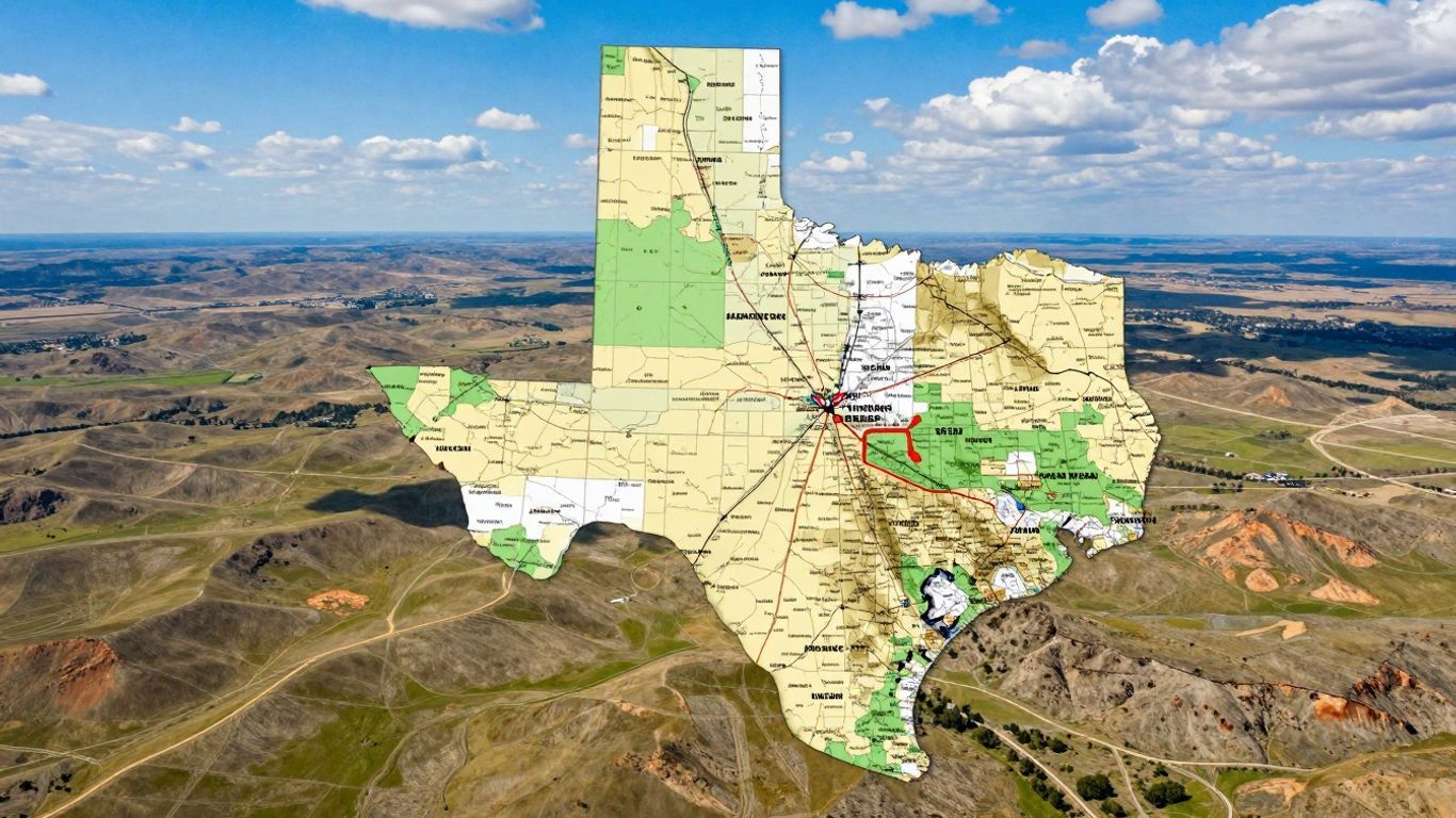
Texas, when viewed on a map, genuinely defies facile categorization. Its sheer magnitude, for starters—ranking as the second-largest state in the U.S. only after Alaska—means an incredible diversity of landscapes lies within its borders. Think about it: one could, quite literally, spend days traversing its length and breadth, encountering everything from vast, flat expanses to gently rolling hills and even imposing mountains in its western reaches.
Geographical Regions of Texas
To truly grasp the topographical character of Texas, it proves immensely helpful to delineate its primary geographical regions. These aren't merely abstract demarcations on a map; rather, they profoundly influence the terrain, climatic conditions, and even the very lifestyles of its inhabitants.
Coastal Plains and Interior Lowlands
Venturing southward along the coastline, one encounters the expansive Gulf Coastal Plains. This region is home to vibrant cities such as Houston and boasts picturesque beaches. Characteristically flat, it features numerous bays and marshes, sustaining a noticeably humid climate. Moving inland, the topography subtly shifts into the Interior Lowlands. Here, the scenery transitions to undulating hills and fertile agricultural lands, ideal for farming and ranching endeavors. It's a rather pronounced shift from the coastal environment—a change truly perceptible as you journey through.
Great Plains and Basin and Range Province
Journeying further north and west, you will ultimately arrive at the Great Plains. This is often the quintessential, wide-open Texas vista many imagine—featuring vast skies, extensive grasslands, and a scarcity of trees. The climate here tends to be quite arid, wouldn't you agree? Farther still, in the state's extreme western sector, lies the Basin and Range Province. This region presents a considerably more rugged topography, characterized by impressive mountains and deep valleys, reminiscent of landscapes found in parts of New Mexico or Arizona. It stands as a stark—indeed, dramatic—contrast to the state's other areas, offering truly breathtaking scenery.
Texas's geography isn't merely a backdrop; it functions as a central character in the state's intricate narrative, profoundly influencing everything from its economic framework to its distinctive culture and the very modes of transportation people utilize.
Here's a quick look at how these regions stack up:
- Gulf Coastal Plains: Characterized by flat terrain, humidity, and abundant coastal areas, bays, and marshes.
- Interior Lowlands: Defined by rolling hills, expansive grasslands, and fertile river valleys, making it highly suitable for agriculture.
- Great Plains: Encompasses vast, open spaces, prairies, and plateaus, typically experiencing a drier climate.
- Basin and Range Province: Features mountainous terrain, pronounced valleys, and arid conditions, particularly in the west.
Major Metropolitan Hubs on the Map of Texas
Texas, a state of impressive scale, boasts urban centers that are every bit as compelling as its diverse natural landscapes. When consulting a map of Texas, one invariably observes several prominent cities that distinguish themselves as vibrant hubs of commerce, cultural expression, and historical depth. These are more than mere points on a diagram; they are dynamic locales, each possessing a singular character.
Houston: The Energy and Space Capital
Houston stands as Texas's most populous city and an undeniable economic powerhouse within the United States. It serves as a fascinating crucible where diverse cultures converge, fostering a rich and engaging tapestry of life. The city's robust economy owes a significant part of its strength to the influential energy industry. However, what truly distinguishes Houston is its profound—and historic—ties to space exploration. The iconic NASA Space Center, a major attraction, provides visitors with an unparalleled opportunity to witness where pivotal historical moments were forged and where the blueprints for future interstellar missions are meticulously crafted. Indeed, it is a city perpetually focused on the horizon.
Dallas: A Center for Business and Culture
Dallas presents itself as a thoroughly modern and ceaselessly active metropolis. Its skyline is punctuated by numerous sleek, contemporary edifices, affirming its status as a pivotal center for national and international businesses. Yet, beyond its corporate veneer, Dallas nurtures a vibrant arts scene and offers a plethora of exceptional shopping and dining experiences. Furthermore, it garners considerable renown for its illustrious football team, the Dallas Cowboys—an integral component of the city's identity. It is, in essence, a locale that skillfully harmonizes high-stakes commerce with a palpable sense of community and ample entertainment.
San Antonio: Rich in History and Heritage
For those with a penchant for history, San Antonio is an absolutely essential destination. This city is profoundly steeped in its past, perhaps most famously recognized for the Alamo—a pivotal battleground in Texas's storied history. A stroll along the iconic River Walk offers a truly unique experience, with an array of charming shops and delightful restaurants gracing the banks of the San Antonio River. It's a city that proudly showcases its rich heritage, inviting visitors to delve into the significant events that indelibly shaped the Lone Star State.
San Antonio offers a distinctive amalgamation of Texan and Mexican cultures, vividly evident in its culinary traditions, architectural styles, and spirited festivals. It truly is a city that celebrates its deep-seated roots with fervor.
These urban centers, however, represent far more than mere population concentrations; they are dynamic destinations that promise a wealth of sights and activities, each weaving its own compelling narrative on the intricate map of Texas.
Exploring Texas's Capital and Western Frontier
Texas, an undeniably vast state, reveals through its geography and urban centers a fascinating mosaic of distinct environments. Having explored some of its larger metropolitan areas, our focus now shifts to the state capital and its compelling far western frontier.
Austin: The Live Music Capital
Austin, of course, is home to the magnificent Texas State Capitol building—a truly impressive edifice that, remarkably, even surpasses the height of its counterpart in Washington D.C. Yet, Austin's identity extends far beyond its governmental functions. The city is globally renowned for its vibrant live music scene; indeed, you'll discover performances almost any evening of the week, with major festivals such as South by Southwest (SXSW) attracting international throngs. Culinary enthusiasts, too, will find much to celebrate here, as a plethora of restaurants and food trucks serve up an eclectic array of delectable dishes.
Fort Worth: Where Cowboys Meet Culture
Journey westward from Austin, and you'll soon arrive in Fort Worth, a city frequently dubbed the "City of Cowboys and Culture." For anyone keen to experience the authentic Western dimension of Texas, the historic Fort Worth Stockyards are an absolute imperative. Here, visitors can witness thrilling rodeos, observe traditional cattle drives, and truly immerse themselves in the enduring cowboy way of life. However, it's not exclusively about boots and ten-gallon hats; Fort Worth also boasts an impressive collection of art museums and galleries, catering to those seeking a dose of refined culture.
El Paso: A Border City of Contrasts
Far to the west, situated directly on the border with Mexico, lies the distinctive city of El Paso. This urban center presents a unique amalgamation of Mexican and American influences. The majestic Franklin Mountains dominate much of the local scenery, affording truly spectacular vistas. El Paso is widely recognized for its welcoming populace and its characteristically warm, desert climate. It offers an unparalleled opportunity to experience vibrant border culture firsthand.
The western reaches of Texas present a dramatically different landscape, characterized by towering mountains and arid deserts. It is home to natural wonders like Big Bend National Park, renowned for its breathtaking canyons and the iconic Rio Grande river. This region truly offers a stark divergence from the coastal plains or interior grasslands.
Here's a quick look at what makes these areas stand out:
- Austin: The seat of state government, a lively hub for live music, and a diverse culinary destination.
- Fort Worth: Steeped in Western heritage, famous for rodeos, and home to significant art museums.
- El Paso: A vibrant blend of border culture, offering stunning mountain views, and set within a desert landscape.
Navigating Texas with Detailed City Maps
Given Texas's sheer scale, a generalized overview sometimes falls short. When the objective is to navigate within a specific city, possessing the appropriate map is absolutely crucial. Indeed, banish any notion of getting disoriented while searching for that elusive street or landmark; the right city map can prove an immense time-saver and significantly reduce potential frustration.
Laminated City Maps for Durability
Designed for longevity, these maps are, quite literally, built to endure. Consider them your indispensable companion for any urban exploration. Typically foldable and crafted from a robust, laminated material, they are perfectly capable of withstanding the rigors of being stowed in a bag or pocket. They're exceptionally suited for frequent use and even permit annotations with a dry-erase marker, which can then be effortlessly wiped away. Whether you're a visitor meticulously planning to see every attraction or a local needing to verify a route, these maps consistently perform with commendable resilience.
Street Atlases for In-Depth Exploration
Should your needs demand a granular view—every street, every alley, every turn—then a comprehensive street atlas is unequivocally your prime choice. These atlases function essentially as exhaustive bound collections of maps tailored for a particular city or metropolitan region. Frequently, they are spiral-bound, a thoughtful design feature that allows them to lie perfectly flat, facilitating an unobstructed view of broader areas. Within their pages, you'll discover a wealth of detailed information, illustrating all major thoroughfares and, importantly, often including even smaller residential streets—a truly invaluable aid for devising intricate routes or pinpointing precise addresses.
Pocket-Sized Maps for On-the-Go Use
There are moments, however, when simplicity and portability are paramount. For these instances, pocket-sized maps are ideally suited. Typically crafted from paper, they are designed to fold compactly, slipping effortlessly into a jacket pocket or a small purse. While perhaps not offering the meticulous detail of a comprehensive atlas, they nonetheless furnish an excellent overview of a city's principal streets and general layout, rendering them perfect for rapid consultation while you're on the move.
Selecting the appropriate map type for your specific requirements is absolutely pivotal. A laminated map excels in durability, an atlas provides unparalleled detail, and a pocket map offers supreme convenience. Making an informed choice translates directly into less stress and more time to truly savor your journey.
Road and Highway Information on Texas Maps
Interstate and US Highway Networks
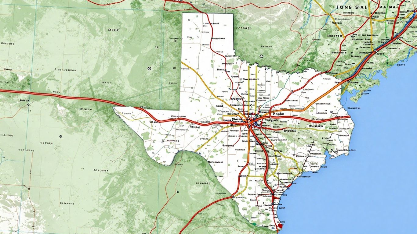
Given its immense expanse, effective navigation across Texas largely hinges on its comprehensive highway infrastructure. The Interstate Highway System, readily identifiable by its familiar shield emblem, efficiently links major cities throughout the state and seamlessly connects Texas to the broader national network. One will encounter vital arteries such as I-10, traversing east-west across the state's southern half; I-35, extending north-south through the crucial central corridor—encompassing Austin, Dallas, and San Antonio; and I-45, which effectively bridges Houston with Dallas. Complementing these are the U.S. Highways, typically denoted by a white shield, which establish significant regional connections and frequently pass through smaller communities not directly served by the Interstates. Truly, these highways form the very backbone of countless road trips and daily commutes.
Detailed Road Maps for Travel
When meticulously planning a journey, particularly one venturing off the well-trodden path, detailed road maps prove to be an indispensable companion—indeed, your best friend. These invaluable resources extend far beyond merely illustrating the principal highways. They frequently incorporate:
- Secondary roads: Think county roads and the distinctive farm-to-market (FM) roads, which can often lead you to some of the state's true hidden gems.
- Township and Range grids: These are especially useful for pinpointing very specific rural locations with precision.
- Points of interest: These can range from cherished state parks and historical markers to intriguing local attractions and convenient rest stops.
- Elevation changes: Some maps will thoughtfully indicate significant shifts in terrain, which can be remarkably helpful for strategically planning your drive.
Mileage Charts and Points of Interest
A great many Texas maps, regardless of whether they are expansive state overviews or granular atlases, thoughtfully include additional helpful features. Mileage charts, for instance, are especially beneficial for accurately estimating travel durations between various cities. They typically enumerate prominent towns and provide the approximate driving distances separating them. Furthermore, you'll discover these maps adorned with various symbols denoting points of interest. Such markers can highlight anything from revered national and state parks to intriguing museums, significant historical sites, and even beloved local eateries. Paying close attention to these symbols truly has the power to transform a routine drive into an engaging adventure.
Strategically planning your route with a robust road map can both conserve valuable time and facilitate the discovery of remarkable places you might otherwise overlook. It remains highly advisable to carry a physical map, even if you rely on GPS, as cellular service can prove intermittent in certain, more remote parts of Texas.
Specialty Maps for Texas Adventures
Beyond the familiar arteries of major highways and the intricate grids of its cities, Texas unfurls an entirely distinct realm for the adventurous explorer. Should your inclination be to venture off the well-worn path, you'll discover specific maps meticulously crafted for precisely such endeavors. Imagine hitting rugged trails or perhaps casting a line into one of the state's myriad lakes. These specialized maps, one might argue, can quite literally make all the difference in the successful planning and enjoyment of your next outdoor excursion.
For enthusiasts of hiking or cycling, Texas presents a surprisingly diverse array of terrain to traverse. One can readily locate maps detailing everything from the challenging, rugged trails of Big Bend National Park to the more gentle paths winding alongside the state's numerous rivers. Some maps even meticulously chart long-distance cycling routes, such as the Transcontinental Cycling Trail that gracefully cuts through the state.
Angling aficionados, too, will unearth a veritable treasure trove of information. Maps dedicated to Texas's abundant lakes and rivers often pinpoint prime fishing locales. These frequently include crucial details like water depth, boat ramp access points, and, occasionally, even common fish species prevalent in specific areas. It’s almost akin to having a local expert guide right in your hands.
And for anyone with a keen interest in the granular geological makeup of the land itself, topographic maps are the definitive choice. These maps meticulously illustrate elevation changes, distinct landforms, and natural features in extraordinary detail. They are indispensable for serious hikers, professional geologists, or simply anyone who appreciates the intricate contours of the land. These comprehensive maps are available for every corner of Texas, depicting everything from the flat expanses of the Panhandle to the undulating hills of the picturesque Hill Country.
Here's a quick look at what you might find:
- Recreation and Hiking Trail Maps: These are specifically designed to highlight trails, parks, and diverse outdoor activities.
- Fishing Maps: Offering precise details on lakes, rivers, and prime fishing hotspots throughout the state.
- Topographic Maps: Providing intricate representations of elevation, landforms, and natural terrain features.
Planning an outdoor adventure in Texas can be immeasurably enhanced with the judicious selection of the right map. Whether your ambition is a demanding hike or a tranquil day spent by the water, these specialized tools furnish the precise detail required to maximize your trip's potential. They provide an understanding of the landscape in a manner that standard road maps simply cannot replicate.
These invaluable maps are frequently obtainable from specialized outdoor retailers or through online map providers. For instance, if you're orchestrating a visit to the vibrant city of Austin, it would be prudent to also seek out maps that intelligently combine city attractions with nearby natural areas for enjoyable day trips.
Your Texas Adventure Awaits
So, we have now thoroughly explored the intricacies of the Texas map, tracing its expanse from wide-open, unblemished spaces to its bustling, dynamic cities. It is, unequivocally, a colossal state—a veritable treasure trove of experiences awaiting discovery. Whether you find yourself captivated by the profound history embedded in San Antonio, the electrifying music scene of Austin, or the relentless dynamism of Houston, rest assured there is a distinct corner of the Lone Star State patiently anticipating your arrival. This guide, truly, serves merely as an initial compass bearing. The most profound way to truly understand Texas is to venture forth and immerse yourself in its exploration. So, procure a map, choose a direction, and embark on your personal journey of discovery. Happy travels indeed!
Frequently Asked Questions
What are the main parts of Texas's land?
Texas is characterized by several distinct types of terrain. Along its coastline, you'll encounter the relatively flat expanse known as the Gulf Coastal Plains. Moving inland, the landscape transitions to the Interior Lowlands, featuring rolling hills and fertile grasslands. Further westward, the vast, open stretches of the Great Plains dominate, while the state's extreme western region gives way to the mountainous and arid environment of the Basin and Range Province.
Which are the biggest cities in Texas?
Among the most prominent cities in Texas are Houston, a sprawling metropolis renowned for its contributions to space exploration and the energy sector; Dallas, a vibrant hub for business and culture; and San Antonio, celebrated for its rich history, including the iconic Alamo, and its picturesque River Walk.
What's special about Austin and Fort Worth?
Austin, the state capital, is famous for its dynamic live music scene and hosts numerous engaging festivals, alongside a thriving culinary landscape. Fort Worth, often affectionately termed the 'City of Cowboys and Culture,' offers authentic Western experiences, such as rodeos at the Stockyards, while also boasting a commendable array of art museums.
What kind of maps are good for Texas trips?
For convenient urban navigation, durable laminated city maps are highly recommended. If you require granular detail for every street and alley, a comprehensive street atlas is your best option. For quick, on-the-go reference, compact pocket-sized maps prove incredibly handy.
How can maps help me drive around Texas?
Road maps are invaluable for identifying primary thoroughfares like Interstates and U.S. highways. They often incorporate helpful supplementary information such as mileage charts for estimating travel times between cities and symbols indicating intriguing points of interest along your route.
Are there maps for outdoor fun in Texas?
Absolutely, specialized maps cater specifically to outdoor adventures in Texas! You can find detailed maps for hiking trails, such as those found in national parks, maps highlighting prime fishing spots on lakes and rivers, and topographic maps that meticulously depict the state's diverse mountains and intricate landforms for in-depth exploration.


